
IMAGES TAKEN NEAR TO
Walton Road, PETERBOROUGH, PE6 7JD
Introduction
This page details the photographs taken nearby to Walton Road, PE6 7JD by members of the Geograph project.
The Geograph project started in 2005 with the aim of publishing, organising and preserving representative images for every square kilometre of Great Britain, Ireland and the Isle of Man.

There are currently over 7.5m images from over14,400 individuals and you can help contribute to the project by visiting https://www.geograph.org.uk
Image Map
Images are licensed for reuse under creativecommons.org/licenses/by-sa/2.0
Notes
- Clicking on the map will re-center to the selected point.
- The higher the marker number, the further away the image location is from the centre of the postcode.
Image Listing (42 Images Found)
Images are licensed for reuse under creativecommons.org/licenses/by-sa/2.0
Image
Details
Distance

2
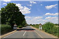
Walton Road entering Marholm
Marholm = 'homestead with a pond' (Old Engkish 'mere' + 'ham') https://www.oxfordreference.com/view/10.1093/acref/9780199609086.001.0001/acref-9780199609086-e-9078?rskey=PbUv1D&result=9161
Image: © Tim Heaton
Taken: 9 Aug 2022
0.05 miles

6
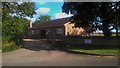
Marholm Village Hall
The village hall, which was built in the 1970s, is located on Castor Road close to the junction with Walton Road and Stamford Road.
Source: https://www.marholmvillage.co.uk/index.php/village-hall/about
Image: © Paul Bryan
Taken: 5 Sep 2019
0.08 miles
7
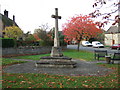
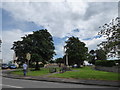
War memorial in Marholm
In the centre of the village of Marholm near Peterborough
Image: © Richard Humphrey
Taken: 2 Nov 2010
0.08 miles
8
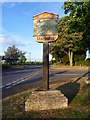
Marholm village sign
One of many attractive village signs hereabouts, Marholm's village sign, just outside the built-up area of Peterborough, is next to the main crossroads and the war memorial.
Image: © Marathon
Taken: 22 May 2011
0.09 miles
9

Ordnance Survey Benchmark - Marholm, 2 Alms Cottage
Ordnance Survey Benchmark (OSBM) used for levelling height above Ordnance Datum (OD).
Height: 17.9771m OD (Newlyn). Mark verified by the Ordnance Survey in 1968. Description: HO N SIDE RD SE ANG S FACE. 0.6m above ground. 3rd Order BM. TF 1487 0214
Close-up: Image
Image: © N Scott
Taken: 21 Jul 2026
0.09 miles
10

Ordnance Survey Benchmark - Marholm, 2 Alms Cottage
Ordnance Survey Benchmark (OSBM) used for levelling height above Ordnance Datum (OD).
Height: 17.9771m OD (Newlyn). Mark verified by the Ordnance Survey in 1968. Description: HO N SIDE RD SE ANG S FACE. 0.6m above ground. 3rd Order BM. TF 1487 0214
Context: Image
Image: © N Scott
Taken: 21 Jul 2026
0.09 miles