
IMAGES TAKEN NEAR TO
Hurn Road, PETERBOROUGH, PE6 7HJ
Introduction
This page details the photographs taken nearby to Hurn Road, PE6 7HJ by members of the Geograph project.
The Geograph project started in 2005 with the aim of publishing, organising and preserving representative images for every square kilometre of Great Britain, Ireland and the Isle of Man.

There are currently over 7.5m images from over14,400 individuals and you can help contribute to the project by visiting https://www.geograph.org.uk
Image Map
Images are licensed for reuse under creativecommons.org/licenses/by-sa/2.0
Notes
- Clicking on the map will re-center to the selected point.
- The higher the marker number, the further away the image location is from the centre of the postcode.
Image Listing (58 Images Found)
Images are licensed for reuse under creativecommons.org/licenses/by-sa/2.0
Image
Details
Distance
1

Houses on Hurn Road, Werrington
These houses on Hurn Road were presumably originally constructed to accommodate railway employees. They are located next to Marholm Crossing, a former level crossing spanning the East Coast Main Line (ECML) and the Peterborough to Leicester line. The crossing was closed to motor traffic in the early 1990s, effectively dividing Hurn Road into two sections, and is now only accessible to pedestrians and cyclists via a footbridge. The former crossing keeper's cottage was demolished in May 2018 and was replaced by a bungalow.
Image: © Paul Bryan
Taken: 29 Aug 2018
0.02 miles
2

Former railway workers' cottages
Built by the Great Northern Railway probably at the time of the opening of the line from Peterborough to Doncaster via Newark in 1851.
Image: © Jonathan Thacker
Taken: 1 Sep 2021
0.02 miles
3
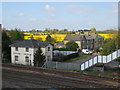
Houses on Hurn Road at Marholm Crossing
This photograph was taken from the footbridge at Marholm Crossing (pronounced locally as Marram), a former level crossing on the main East Coast railway line and Peterborough to Leicester line. The crossing was closed to motor traffic in the early 1990s, effectively dividing Hurn Road into two sections, and is now only accessible to pedestrians and cyclists via the footbridge.
UPDATE: The former crossing keeper's cottage was demolished in May 2018 and was replaced by a bungalow on the same plot but slightly further away from the tracks.
Image: © Paul Bryan
Taken: 19 Apr 2014
0.03 miles
4

Abandoned project?
The crossing keeper's cottage which existed here Image has been demolished and this bungalow has been built as a replacement but seems to have been abandoned.
Image: © Jonathan Thacker
Taken: 1 Sep 2021
0.04 miles
5
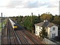
East Coast train at the former Hurn Road crossing, Marholm
An East Coast train heading in the direction of Peterborough passes the former crossing keeper's cottage at Hurn Road crossing near Marholm (pronounced locally as Marram). The crossing was closed to motor traffic in the early 1990s, effectively dividing Hurn Road into two sections, and is now only accessible to pedestrians and cyclists via a footbridge spanning both the East Coast Main Line (ECML) and the Peterborough to Leicester line.
UPDATE: The former crossing keeper's cottage was demolished in May 2018 and was replaced by a bungalow on the same plot but slightly further away from the tracks. For an image of the bungalow, please see: Image
Image: © Paul Bryan
Taken: 10 Oct 2014
0.05 miles
6
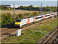
Virgin train on the East Coast Main Line near Marholm
This Virgin train heads northward on the East Coast Main Line (ECML) shortly after its departure from Peterborough. It is seen from the footbridge over the former level crossing on Hurn Road near Marholm (pronounced locally as Marram). The crossing was closed to motor traffic in the early 1990s, effectively dividing Hurn Road into two sections, and is now only accessible to pedestrians and cyclists via a footbridge spanning both the ECML and the Peterborough to Leicester line.
Image: © Paul Bryan
Taken: 2 Oct 2015
0.06 miles
7

Hurn Road bridge
Replaced Marholm Crossing.
Image: © Jonathan Thacker
Taken: 1 Sep 2021
0.06 miles
8
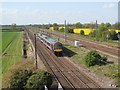
Train on the Peterborough to Leicester line at Marholm Crossing
This photograph was taken from the footbridge at Marholm Crossing (pronounced locally as Marram), a former level crossing on Hurn Road. The train is heading towards Peterborough on the line from Leicester. The East Coast main line can be seen on the right of the image. The crossing was closed to motor traffic in the early 1990s, effectively dividing Hurn Road into two sections, and is now only accessible to pedestrians and cyclists via the footbridge.
Image: © Paul Bryan
Taken: 19 Apr 2014
0.06 miles
9
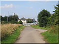
Former level crossing on Hurn Road, Marholm
Marholm Crossing - pronounced locally as Marram - is a former level crossing on the East Coast Main Line (ECML) and Peterborough to Leicester line. The crossing was closed to motor traffic in the early 1990s, effectively dividing Hurn Road into two sections, and is now only accessible to pedestrians and cyclists via a footbridge.
Image: © Paul Bryan
Taken: 18 Jul 2014
0.07 miles
10

An East Coast 225 from Hurn Road footbridge
The roads leading north from the crossroads at Marholm are effectively dead ends for anyone in a car. Hurn Road ends up at a footbridge over the East Coast Main Line, whilst the rather longer Woodcroft Road ends up at the gated Woodcroft Crossing where it is possible to cross but warning notices state that it could be a 30 minute delay. This is the view from the footbridge at the end of Hurn Road near Gate House Farm. Clearly this was once a level crossing. The East Coast Main Line is on the nearside whilst the two tracks on the far left belong to the line from Peterborough to Stamford. An East Coast 225 heads away from Peterborough.
Image: © Marathon
Taken: 27 May 2011
0.07 miles