
IMAGES TAKEN NEAR TO
Carringtons Road North, PETERBOROUGH, PE6 0GA
Introduction
This page details the photographs taken nearby to Carringtons Road North, PE6 0GA by members of the Geograph project.
The Geograph project started in 2005 with the aim of publishing, organising and preserving representative images for every square kilometre of Great Britain, Ireland and the Isle of Man.

There are currently over 7.5m images from over14,400 individuals and you can help contribute to the project by visiting https://www.geograph.org.uk
Image Map
Images are licensed for reuse under creativecommons.org/licenses/by-sa/2.0
Notes
- Clicking on the map will re-center to the selected point.
- The higher the marker number, the further away the image location is from the centre of the postcode.
Image Listing (13 Images Found)
Images are licensed for reuse under creativecommons.org/licenses/by-sa/2.0
Image
Details
Distance
1

A16 towards Peterborough
Nearing the roundabout south of Crowland.
Image: © Robin Webster
Taken: 2 May 2021
0.10 miles

3

Road Junction
New road junction on the new A16(A1073) turn right to the poultry farm
Image: © Morris Doris
Taken: 4 Aug 2010
0.14 miles
4
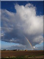
Rainbow in the wings
Like a huge white owl looking from above, this cloud was hiding the end of a rainbow beneath its wings. A small track near the roundabout provided a great vantage point from where to watch the scene grow and melt away as if it never happened.
Image: © Ian Paterson
Taken: 11 Oct 2016
0.17 miles

6

Road construction, Crowland
A bulldozer and a compactor working on the new Eye to Spalding road.
Image: © Michael Trolove
Taken: 18 Jun 2009
0.19 miles
7

Little houses
I was struck how small these houses seem in the vast fenland landscape
Image: © Bob Harvey
Taken: 27 Jul 2018
0.19 miles


10

Abbey, Summer Gold, and Houses
About 180 degrees of panorama of the wheat crop at Crowland, with the new houses beyond. On the horizon at the left the Abbey.
Image: © Bob Harvey
Taken: 27 Jul 2018
0.22 miles