
IMAGES TAKEN NEAR TO
Milton Lane, PETERBOROUGH, PE5 7DH
Introduction
This page details the photographs taken nearby to Milton Lane, PE5 7DH by members of the Geograph project.
The Geograph project started in 2005 with the aim of publishing, organising and preserving representative images for every square kilometre of Great Britain, Ireland and the Isle of Man.

There are currently over 7.5m images from over14,400 individuals and you can help contribute to the project by visiting https://www.geograph.org.uk
Image Map
Images are licensed for reuse under creativecommons.org/licenses/by-sa/2.0
Notes
- Clicking on the map will re-center to the selected point.
- The higher the marker number, the further away the image location is from the centre of the postcode.
Image Listing (371 Images Found)
Images are licensed for reuse under creativecommons.org/licenses/by-sa/2.0
Image
Details
Distance
1
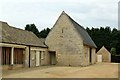
Barn by the Village Hall, Castor
18th century stone barn, sympathetically converted to office use with restored thatched roof (when listed it had a tiled roof), Listed Grade II.
Image: © Alan Murray-Rust
Taken: 26 Jun 2016
0.02 miles
2
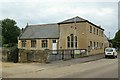
Village Hall, Castor
This started life as the village school, built in 1829 by the fifth Earl Fitzwilliam. Originally it was a single room, single storey building fronting the road, the wing to the left being added around 1900. It closed as a school in 1956, and then became the Village Hall, the upper storey being added at this time. Coursed stone rubble with Welsh slate roof, Listed Grade II.
Image: © Alan Murray-Rust
Taken: 26 Jun 2016
0.02 miles
3

The Village Hall, Castor
Built as a school in 1829 https://historicengland.org.uk/listing/the-list/list-entry/1163203?section=official-list-entry
Image: © Jonathan Thacker
Taken: 22 Oct 2022
0.02 miles
4

43 and 45 Peterborough Road, Castor
Date from the early eighteenth century https://historicengland.org.uk/listing/the-list/list-entry/1309268?section=official-list-entry
Image: © Jonathan Thacker
Taken: 22 Oct 2022
0.03 miles
5
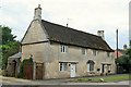
43 and 45 Peterborough Road, Castor
Built in the early 18th century, this is an early example of a symmetrical semi-detached pair of houses. Coursed stone rubble with Collyweston stone slate roof, Listed Grade II.
Image: © Alan Murray-Rust
Taken: 26 Jun 2016
0.04 miles
6
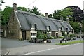
The Fitzwilliam Arms, Castor
17th century, thought to have been built as a coaching inn rather than being a later conversion. It became a restaurant in the mid 1990s, but at the time of my visit it appeared to be closed up. Coursed stone rubble with thatched roof, Listed Grade II.
Image: © Alan Murray-Rust
Taken: 26 Jun 2016
0.04 miles
7

The Fitzwilliam Arms, Castor
Dates from the seventeenth century https://historicengland.org.uk/listing/the-list/list-entry/1331572?section=official-list-entry
Image: © Jonathan Thacker
Taken: 22 Oct 2022
0.04 miles
8

The (former) Fitzwilliam Arms
Appears to be closed and up for sale. Built in C17. See http://www.britishlistedbuildings.co.uk/en-49962-the-fitzwilliam-arms-castor-#.VaDnx_lViko for entry in British Listed Buildings.
Image: © Bikeboy
Taken: 27 Jun 2015
0.05 miles
9
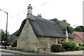
The Old Smithy, Peterborough Road, Castor
The main part of the house (see http://www.geograph.org.uk/photo/5024642 ) is early 17th century, with the projecting wing being a later addition, dated 1676 http://www.geograph.org.uk/photo/5024641 ; coursed stone rubble with thatched roof, Listed Grade II.
Image: © Alan Murray-Rust
Taken: 26 Jun 2016
0.06 miles
10
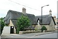
The Old Smithy, Peterborough Road, Castor
The main house, to the left, is early 17th century, the wing to the right added later in that century http://www.geograph.org.uk/photo/5024641 . Coursed stone rubble with thatched roof, Listed Grade II.
Image: © Alan Murray-Rust
Taken: 26 Jun 2016
0.06 miles