
IMAGES TAKEN NEAR TO
The Limes, PETERBOROUGH, PE5 7BH
Introduction
This page details the photographs taken nearby to The Limes, PE5 7BH by members of the Geograph project.
The Geograph project started in 2005 with the aim of publishing, organising and preserving representative images for every square kilometre of Great Britain, Ireland and the Isle of Man.

There are currently over 7.5m images from over14,400 individuals and you can help contribute to the project by visiting https://www.geograph.org.uk
Image Map
Images are licensed for reuse under creativecommons.org/licenses/by-sa/2.0
Notes
- Clicking on the map will re-center to the selected point.
- The higher the marker number, the further away the image location is from the centre of the postcode.
Image Listing (363 Images Found)
Images are licensed for reuse under creativecommons.org/licenses/by-sa/2.0
Image
Details
Distance

2
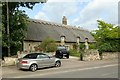
Three Chimneys, Peterborough Road, Castor
Formerly a range of cottages, now converted into a single house, 17th century, coursed stone rubble with thatched roof, Listed Grade II.
Image: © Alan Murray-Rust
Taken: 26 Jun 2016
0.03 miles

4
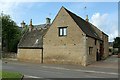
Converted range of farm buildings, Peterborough Road, Castor
The range dates back to around 1700 and comprises barn with stables beyond and a small brewhouse attached to the left. All are built of coursed stone rubble with Collyweston stone slate roofs, Listed Grade II.
Image: © Alan Murray-Rust
Taken: 26 Jun 2016
0.03 miles
5

6a Peterborough Road, Castor
Former stables and brewhouse dating from the seventeenth and eighteenth centuries https://historicengland.org.uk/listing/the-list/list-entry/1162946?section=official-list-entry Now housing.
Image: © Jonathan Thacker
Taken: 22 Oct 2022
0.03 miles
6
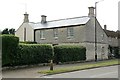
The Hollies Farmhouse, Castor
Early 19th century 3-bay house in dressed stone with Welsh slate roof, Listed Grade II.
Image: © Alan Murray-Rust
Taken: 26 Jun 2016
0.06 miles
7
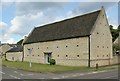
Barn at Home Farm, Castor
Probably early 18th century, coursed stone rubble with Collyweston stone slate roof, now converted to residential use. Listed Grade II.
Image: © Alan Murray-Rust
Taken: 26 Jun 2016
0.06 miles
8

Peterborough Road, Castor
Home Farm is the building on the right
Image: © David Howard
Taken: 27 Apr 2019
0.07 miles
9

House on Peterborough Road, Castor
This was probably owned by a local landowner originally
Image: © David Howard
Taken: 27 Apr 2019
0.08 miles
10
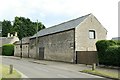
Barn at Hollies Farm, Castor
Early to mid 19th century barn, coursed stone rubble with Welsh slate roof, Listed Grade II for group value.
Image: © Alan Murray-Rust
Taken: 26 Jun 2016
0.08 miles