
IMAGES TAKEN NEAR TO
Church Hill, PETERBOROUGH, PE5 7AU
Introduction
This page details the photographs taken nearby to Church Hill, PE5 7AU by members of the Geograph project.
The Geograph project started in 2005 with the aim of publishing, organising and preserving representative images for every square kilometre of Great Britain, Ireland and the Isle of Man.

There are currently over 7.5m images from over14,400 individuals and you can help contribute to the project by visiting https://www.geograph.org.uk
Image Map
Images are licensed for reuse under creativecommons.org/licenses/by-sa/2.0
Notes
- Clicking on the map will re-center to the selected point.
- The higher the marker number, the further away the image location is from the centre of the postcode.
Image Listing (365 Images Found)
Images are licensed for reuse under creativecommons.org/licenses/by-sa/2.0
Image
Details
Distance
1

Former stable block for The Elms, Church Hill, Castor
Early 19th century, two storey, originally with hayloft on the upper floor, now converted to residential use, Listed Grade II for group value.
Image: © Alan Murray-Rust
Taken: 26 Jun 2016
0.02 miles
2
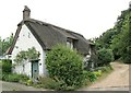
11 Church Hill, Castor
Early 17th century cottage, whitewashed coursed stone rubble with thatched roof, Listed Grade II.
Image: © Alan Murray-Rust
Taken: 26 Jun 2016
0.03 miles
3

The Old Chapel, Church Hill, Castor
Built in 1848 as a Congregational Chapel, with a later extension to the right, it closed in 1975 and was finally refurbished in 1991 to become offices. It is currently in use by a pharmacy business.
Image: © Alan Murray-Rust
Taken: 26 Jun 2016
0.04 miles
4
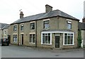
Former village shop, The Green Castor
This looks as if it has simply been picked up out of any late 19th/early 20th century urban development and dropped into the village. It was built around 1915 to replace an older shop.
Image: © Alan Murray-Rust
Taken: 26 Jun 2016
0.05 miles
5

'Durobrivae', The Green, Castor
One of two buildings in the village to be Listed Grade II*, it takes its name from the nearby Roman settlement. Built in the early 18th century, it has a fine front with rusticated architraves which can just about be appreciated from this angle.
Image: © Alan Murray-Rust
Taken: 26 Jun 2016
0.05 miles
6

The Cedars, Castor
This is the house to the left, one of the larger houses of the village, a two-pile structure dating from the early 18th century and Listed Grade II.
Image: © Alan Murray-Rust
Taken: 26 Jun 2016
0.06 miles
7

The Green and Farmers' Cross at Castor
A very unusual, if not unique, feature, the Farmers' Cross on The Green at Castor is actually the village cross which was restored in thanksgiving for the farmers and those who worked on the land to feed the people of the five local parishes. The individual farms are listed together with a little more detail on the plaque at the base - see http://www.geograph.org.uk/photo/2446350
Image: © Marathon
Taken: 22 May 2011
0.06 miles
8

The (former) Fitzwilliam Arms
Appears to be closed and up for sale. Built in C17. See http://www.britishlistedbuildings.co.uk/en-49962-the-fitzwilliam-arms-castor-#.VaDnx_lViko for entry in British Listed Buildings.
Image: © Bikeboy
Taken: 27 Jun 2015
0.06 miles
9

The Green
Houses on the Green, Castor.
Image: © Wayland Smith
Taken: 29 Sep 2012
0.06 miles
10
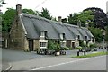
The Fitzwilliam Arms, Castor
17th century, thought to have been built as a coaching inn rather than being a later conversion. It became a restaurant in the mid 1990s, but at the time of my visit it appeared to be closed up. Coursed stone rubble with thatched roof, Listed Grade II.
Image: © Alan Murray-Rust
Taken: 26 Jun 2016
0.07 miles