
IMAGES TAKEN NEAR TO
Peterborough Road, PETERBOROUGH, PE5 7AJ
Introduction
This page details the photographs taken nearby to Peterborough Road, PE5 7AJ by members of the Geograph project.
The Geograph project started in 2005 with the aim of publishing, organising and preserving representative images for every square kilometre of Great Britain, Ireland and the Isle of Man.

There are currently over 7.5m images from over14,400 individuals and you can help contribute to the project by visiting https://www.geograph.org.uk
Image Map
Images are licensed for reuse under creativecommons.org/licenses/by-sa/2.0
Notes
- Clicking on the map will re-center to the selected point.
- The higher the marker number, the further away the image location is from the centre of the postcode.
Image Listing (26 Images Found)
Images are licensed for reuse under creativecommons.org/licenses/by-sa/2.0
Image
Details
Distance
1

Ordnance Survey Flush Bracket 1035
This can be found on the wall of a building in High Street, Ailsworth.
For more detail see : http://www.bench-marks.org.uk/bm721
Image: © Peter Wood
Taken: 18 Jul 2014
0.01 miles
2

Peterborough Road, Ailsworth
The building on the left could have been a public house or inn as it has the remains of a sign hanging over the door. Was the broad strip above the windows on the first floor also for a sign and why were all the windows on the second floor bricked up?
Image: © Marathon
Taken: 22 May 2011
0.02 miles

4

Bench mark on the former pub in Ailsworth
A cut mark inscribed on the road frontage and to the right hand side of the front door.
Image: © Michael Trolove
Taken: 13 Mar 2011
0.04 miles
5

Ailsworth village green
Early signs of spring as the daffodils are starting to make a show. The house to the right of the phone box was a former pub and the structure on the left of the phone box is a bus stop that also serves as a war memorial with an inscribed plaque inside.
Image: © Michael Trolove
Taken: 13 Mar 2011
0.04 miles
6

Street scene in Ailsworth
The end house was a pub, either the Wheat-Sheaf or the Barley Mow (to be confirmed) and the road was formerly the A47 now realigned with numerous traffic calming measures, The village is now bypassed.
Image: © Michael Trolove
Taken: 13 Mar 2011
0.04 miles
7

Former public house in Peterborough Road, Ailsworth
The remains of the hanging sign on the right give the clue that this was once a public house.
Image: © Marathon
Taken: 22 May 2011
0.04 miles
8

Ailsworth Village Green
Ailsworth and its close neighbour Castor lie to the west of Peterborough. At one time this pleasant village scene would have been on the main road west from the city but the traffic now passes to the north on a modern bypass. The 'Station Rd' sign gives a clue as to where the road on the right used to lead. The station itself was about a mile from the village on what is now the Nene Valley Railway Image
Image: © Mike Bardill
Taken: 29 Apr 2006
0.05 miles
9
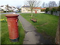
Phone box and pillar box in Ailsworth, Peterborough
Image: © Richard Humphrey
Taken: 5 Mar 2014
0.05 miles
10

Ailsworth street scene
The road was formerly the A47 but now features numerous traffic calming measures. The village is now bypassed. The slab fronted building was possibly another pub as there is a metal brace protruding from the 2nd floor for hanging a sign.
Was this the Barley Mow ?
Image: © Michael Trolove
Taken: 13 Mar 2011
0.06 miles