
IMAGES TAKEN NEAR TO
Gunthorpe Road, PETERBOROUGH, PE4 7DS
Introduction
This page details the photographs taken nearby to Gunthorpe Road, PE4 7DS by members of the Geograph project.
The Geograph project started in 2005 with the aim of publishing, organising and preserving representative images for every square kilometre of Great Britain, Ireland and the Isle of Man.

There are currently over 7.5m images from over14,400 individuals and you can help contribute to the project by visiting https://www.geograph.org.uk
Image Map
Images are licensed for reuse under creativecommons.org/licenses/by-sa/2.0
Notes
- Clicking on the map will re-center to the selected point.
- The higher the marker number, the further away the image location is from the centre of the postcode.
Image Listing (17 Images Found)
Images are licensed for reuse under creativecommons.org/licenses/by-sa/2.0
Image
Details
Distance
1
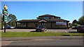
The Harrier, Gunthorpe
The Harrier is located on Gunthorpe Road next to the junction with Gunthorpe Ridings. The pub forms part of the Hungry Horse chain. It was scheduled to undergo refurbishment in late 2019.
Source: https://whatpub.com/pubs/PET/226/harrier-peterborough
Image: © Paul Bryan
Taken: 19 Sep 2019
0.10 miles
2

Benchmark on Flat Nos. 2-18 Watt Close
Ordnance Survey cut mark benchmark described on the Bench Mark Database at www.bench-marks.org.uk/bm88571
Image: © phil Richards
Taken: 23 Sep 2017
0.11 miles
4

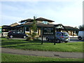
Flats Nos. 2-18 Watt Close at junction with Donaldson Drive
There is an Ordnance Survey benchmark Image on the near corner, left hand face, of the block, under the satellite dishes
Image: © phil Richards
Taken: 23 Sep 2017
0.11 miles
5
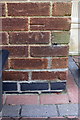
Benchmark on No. 122 Gunthorpe Road
Ordnance Survey cut mark benchmark described on the Bench Mark Database at www.bench-marks.org.uk/bm88570
Image: © phil Richards
Taken: 23 Sep 2017
0.14 miles
6
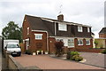
Nos. 122 and 120 Gunthorpe Road
There is an Ordnance Survey benchmark Image on the side of the left hand house at its near corner
Image: © phil Richards
Taken: 23 Sep 2017
0.15 miles
7
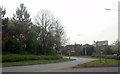
Roundabout exit to Gunthorpe
Exit to Gunthorpe and Paston from a roundabout on the A15, Peterborough.
Image: © Ajay Tegala
Taken: 14 Apr 2009
0.16 miles
10

Wall on south side of Tudor Close
The house in the background is No. 80 Hallfields Lane. There is an Ordnance Survey benchmark Image on the corner, right hand face, of the brick wall
Image: © phil Richards
Taken: 23 Sep 2017
0.22 miles