
IMAGES TAKEN NEAR TO
Artindale, PETERBOROUGH, PE3 9YL
Introduction
This page details the photographs taken nearby to Artindale, PE3 9YL by members of the Geograph project.
The Geograph project started in 2005 with the aim of publishing, organising and preserving representative images for every square kilometre of Great Britain, Ireland and the Isle of Man.

There are currently over 7.5m images from over14,400 individuals and you can help contribute to the project by visiting https://www.geograph.org.uk
Image Map
Images are licensed for reuse under creativecommons.org/licenses/by-sa/2.0
Notes
- Clicking on the map will re-center to the selected point.
- The higher the marker number, the further away the image location is from the centre of the postcode.
Image Listing (11 Images Found)
Images are licensed for reuse under creativecommons.org/licenses/by-sa/2.0
Image
Details
Distance
4
#127 Atherstone Avenue at Knole Walk junction
Ordnance Survey documents indicate that in 1979 a benchmark levelled at 20.306m above Newlyn Datum was verified on the garage of the house at this location. See www.bench-marks.org.uk/bm88352
Image: © Roger Templeman
Taken: 10 Sep 2017
0.20 miles
6
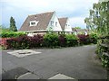
Houses on Arbury Close, Peterborough
A path on this [the south] side, the road on the north side.
Image: © Christine Johnstone
Taken: 25 Jun 2016
0.21 miles
7
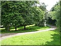
Cycleway and footpath to South Bretton, Peterborough
Curving round to cross the A47.
Image: © Christine Johnstone
Taken: 25 Jun 2016
0.22 miles

9

Replacement of the Longthorpe footbridge over the A47
Doesn't seem to be anything wrong with the existing footbridge, built in 1970, but a recent assessment found some defects. "The new footbridge will have modern, up-to-date access ramps which will help make it more accessible and help those with prams, pushchairs and bicycles cross the A47 more easily. To make room for the new ramps, we will need to remove about 100 trees from alongside the A47. We know trees are important, helping screen the A47 and supporting local wildlife. We’re working with a local charity to replace each tree we remove with another one and complying with Peterborough City Council's policy." https://nationalhighways.co.uk/our-roads/east/a47-longthorpe-footbridge-replacement/ . The installation of the beams for the new bridge will require a weekend closure of this busy dual carriageway.
Good to see Peterborough's continuing efforts towards "Creating the UK’s Environment Capital" https://www.peterborough.gov.uk/council/campaigns/environment-capital
Image: © Tim Heaton
Taken: 9 Aug 2022
0.22 miles
10
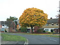
Orange tree in Atherstone Avenue, Westwood, Peterborough
Image: © Richard Humphrey
Taken: 2 Nov 2010
0.23 miles