
IMAGES TAKEN NEAR TO
Atherstone Avenue, PETERBOROUGH, PE3 9UN
Introduction
This page details the photographs taken nearby to Atherstone Avenue, PE3 9UN by members of the Geograph project.
The Geograph project started in 2005 with the aim of publishing, organising and preserving representative images for every square kilometre of Great Britain, Ireland and the Isle of Man.

There are currently over 7.5m images from over14,400 individuals and you can help contribute to the project by visiting https://www.geograph.org.uk
Image Map
Images are licensed for reuse under creativecommons.org/licenses/by-sa/2.0
Notes
- Clicking on the map will re-center to the selected point.
- The higher the marker number, the further away the image location is from the centre of the postcode.
Image Listing (10 Images Found)
Images are licensed for reuse under creativecommons.org/licenses/by-sa/2.0
Image
Details
Distance
1
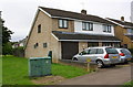
#127 Atherstone Avenue at Knole Walk junction
Ordnance Survey documents indicate that in 1979 a benchmark levelled at 20.306m above Newlyn Datum was verified on the garage of the house at this location. See www.bench-marks.org.uk/bm88352
Image: © Roger Templeman
Taken: 10 Sep 2017
0.05 miles
2
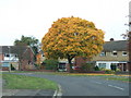
Orange tree in Atherstone Avenue, Westwood, Peterborough
Image: © Richard Humphrey
Taken: 2 Nov 2010
0.07 miles
3
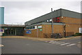
Jack Hunt Pool and Gym
Ordnance Survey documents indicate that in 1979 a benchmark levelled at 18.575m above Newlyn Datum was verified on the school gymnasium close to this location. I suspect the present building replaced the one to which the OS referred?
Image: © phil Richards
Taken: 22 Oct 2017
0.13 miles
4
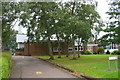
Thorpe County Primary School
There is an Ordnance Survey benchmark Image on the face of the school building following the line of pathside logs
Image: © phil Richards
Taken: 22 Oct 2017
0.15 miles
5
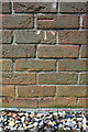
Benchmark on Thorpe County Primary School
Ordnance Survey cut mark benchmark described on the Bench Mark Database at www.bench-marks.org.uk/bm88459
Image: © phil Richards
Taken: 22 Oct 2017
0.15 miles
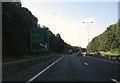
7
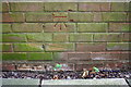
Benchmark on small brick building near Bramhall Court shops
Ordnance Survey cut mark benchmark described on the Bench Mark Database at www.bench-marks.org.uk/bm88460
Image: © phil Richards
Taken: 22 Oct 2017
0.21 miles
8
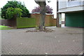
Brick building next to electricity substation, Bramhall Court
There is an Ordnance Survey benchmark Image on the small brick building beyond the tree trunk
Image: © phil Richards
Taken: 22 Oct 2017
0.21 miles
9
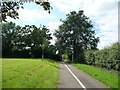
Cycleway and footpath to South Bretton, Peterborough
Heading west to Bradwell Road.
Image: © Christine Johnstone
Taken: 25 Jun 2016
0.24 miles
10
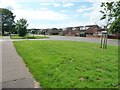
Bradwell Road, Longthorpe, Peterborough
Looking west at the junction with Harewood Gardens.
Image: © Christine Johnstone
Taken: 25 Jun 2016
0.24 miles