
IMAGES TAKEN NEAR TO
Morpeth Road, PETERBOROUGH, PE3 9PE
Introduction
This page details the photographs taken nearby to Morpeth Road, PE3 9PE by members of the Geograph project.
The Geograph project started in 2005 with the aim of publishing, organising and preserving representative images for every square kilometre of Great Britain, Ireland and the Isle of Man.

There are currently over 7.5m images from over14,400 individuals and you can help contribute to the project by visiting https://www.geograph.org.uk
Image Map
Images are licensed for reuse under creativecommons.org/licenses/by-sa/2.0
Notes
- Clicking on the map will re-center to the selected point.
- The higher the marker number, the further away the image location is from the centre of the postcode.
Image Listing (27 Images Found)
Images are licensed for reuse under creativecommons.org/licenses/by-sa/2.0
Image
Details
Distance
1
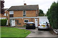
No. 26 Audley Gate
There is an Ordnance Survey benchmark Image in the bricks on the right hand side of the garage door
Image: © phil Richards
Taken: 22 Oct 2017
0.09 miles
2

Benchmark on garage of No. 26 Audley Gate
Ordnance Survey cut mark benchmark described on the Bench Mark Database at www.bench-marks.org.uk/bm88461
Image: © phil Richards
Taken: 22 Oct 2017
0.09 miles
3
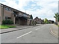
Berkeley Road, Peterborough
Looking north-west from the junction with Thorpe Park Road.
Image: © Christine Johnstone
Taken: 25 Jun 2016
0.10 miles
4
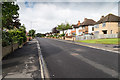
Thorpe Park Road
View south west along Thorpe Park Road.
Image: © David P Howard
Taken: 26 Jun 2016
0.12 miles
5
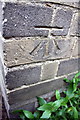
Benchmark on No.23 Thorpe Park Road
Ordnance Survey cut mark benchmark described on the Bench Mark Database at www.bench-marks.org.uk/bm88465
Image: © phil Richards
Taken: 22 Oct 2017
0.13 miles
6
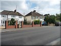
Houses in Thorpe Park Road, Peterborough
On the south side.
Image: © Christine Johnstone
Taken: 25 Jun 2016
0.14 miles
7
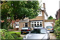
No. 23 Thorpe Park Road
There is an Ordnance Survey benchmark Image on the right hand side of the house at its front corner
Image: © phil Richards
Taken: 22 Oct 2017
0.14 miles
8
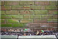
Benchmark on small brick building near Bramhall Court shops
Ordnance Survey cut mark benchmark described on the Bench Mark Database at www.bench-marks.org.uk/bm88460
Image: © phil Richards
Taken: 22 Oct 2017
0.15 miles
9
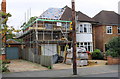
No. 49 Thorpe Park Road
The house is being extended over the attached garage on its northeast face. Ordnance Survey documents indicate that in 1965 a benchmark levelled at 13.603m above Newlyn Datum was verified on the left hand side of the garage at its front corner. Whether the mark has survived the building works is unknown.
Image: © phil Richards
Taken: 10 Sep 2017
0.15 miles
10
Brick building next to electricity substation, Bramhall Court
There is an Ordnance Survey benchmark Image on the small brick building beyond the tree trunk
Image: © phil Richards
Taken: 22 Oct 2017
0.16 miles