IMAGES TAKEN NEAR TO
Fulham Road, PETERBOROUGH, PE3 9EJ
Introduction
This page details the photographs taken nearby to Fulham Road, PE3 9EJ by members of the Geograph project.
The Geograph project started in 2005 with the aim of publishing, organising and preserving representative images for every square kilometre of Great Britain, Ireland and the Isle of Man.

There are currently over 7.5m images from over14,400 individuals and you can help contribute to the project by visiting https://www.geograph.org.uk
Image Map
Images are licensed for reuse under creativecommons.org/licenses/by-sa/2.0
Notes
- Clicking on the map will re-center to the selected point.
- The higher the marker number, the further away the image location is from the centre of the postcode.
Image Listing (66 Images Found)
Images are licensed for reuse under creativecommons.org/licenses/by-sa/2.0
Image
Details
Distance
1
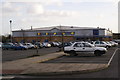
The new Leisure complex built 2005
Along with a discount supermarket and a fitness centre
Image: © Chris Stafford
Taken: 18 Jan 2007
0.11 miles
2

Nicholls Avenue, Peterborough
Running north from Mayor's Walk.
Image: © Christine Johnstone
Taken: 25 Jun 2016
0.16 miles
3

Roadworks on Priory Road, Peterborough
Looking north from the junction with Mayor's Walk.
Image: © Christine Johnstone
Taken: 25 Jun 2016
0.16 miles
4

Benchmark on No. 40 Grange Road
Ordnance Survey cut mark benchmark described on the Bench Mark Database at www.bench-marks.org.uk/bm88363
Image: © phil Richards
Taken: 22 Oct 2017
0.16 miles
5

Nos. 54 and 56 Grange Road
There is an Ordnance Survey benchmark Image on the side of the nearer house at its front corner
Image: © phil Richards
Taken: 22 Oct 2017
0.16 miles
6

Benchmark on No. 56 Grange Road
Ordnance Survey cut mark benchmark described on the Bench Mark Database at www.bench-marks.org.uk/bm88362
Image: © phil Richards
Taken: 22 Oct 2017
0.17 miles
8
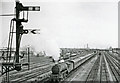
King's Cross - Newcastle express leaving Peterborough North
View southward from Westwood Bridge on the ECML, towards Peterborough and London. On the left are the Westwood and Spital Yard; the Midland lines to Stamford etc. are on the right; the signals in the foreground belong to Westwood Junction, where connection is made between the ECML and Midland lines; Spital Bridge is in the distance. The express is headed by Gresley V2 2-6-2 No. 60850 (built 3/39 as No. 4821 (No. 750, then No. 850 in 1946), withdrawn 2/62).
Image: © Ben Brooksbank
Taken: 15 Aug 1959
0.17 miles
9
Westwood Bridge taking Westfield Road over East Coast Main Line railway
There is an Ordnance Survey benchmark Image 1 foot from the left hand end of the bridge parapet
Image: © phil Richards
Taken: 22 Oct 2017
0.17 miles