
IMAGES TAKEN NEAR TO
The Drive, PETERBOROUGH, PE3 6AJ
Introduction
This page details the photographs taken nearby to The Drive, PE3 6AJ by members of the Geograph project.
The Geograph project started in 2005 with the aim of publishing, organising and preserving representative images for every square kilometre of Great Britain, Ireland and the Isle of Man.

There are currently over 7.5m images from over14,400 individuals and you can help contribute to the project by visiting https://www.geograph.org.uk
Image Map
Images are licensed for reuse under creativecommons.org/licenses/by-sa/2.0
Notes
- Clicking on the map will re-center to the selected point.
- The higher the marker number, the further away the image location is from the centre of the postcode.
Image Listing (50 Images Found)
Images are licensed for reuse under creativecommons.org/licenses/by-sa/2.0
Image
Details
Distance
1
A1179 Thorpe Road, Peterborough
At the entrance to Peterborough City Care Centre
Image: © Geographer
Taken: 25 Jun 2016
0.09 miles
2
A1179 Thorpe Road, Peterborough
At the entrance to Peterborough City Care Centre
Image: © Geographer
Taken: 25 Jun 2016
0.09 miles
3
A1179 Thorpe Road, Peterborough
At the entrance to Peterborough City Care Centre
Image: © Geographer
Taken: 25 Jun 2016
0.09 miles
4
A1179 Thorpe Road, Peterborough
At the entrance to Peterborough City Care Centre
Image: © Geographer
Taken: 25 Jun 2016
0.09 miles
5

Cycle Route 63 approaching Peterborough City Centre
Image: © Tim Heaton
Taken: 15 Jun 2020
0.10 miles
6
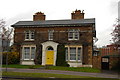
64 Thorpe Road, Peterborough
Built in 1836 and largely unaltered. It has a shallow pitched Welsh slate roof, impressive brick chimneys, round arched first floor windows, ground floor bay windows and door-case. Currently being used as Thorpe Road surgery. Listed in the Peterborough Local Plan, Appendix VI as a building of local importance.
Image: © Julian Dowse
Taken: 20 Apr 2006
0.11 miles
7
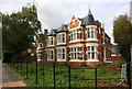
#60 Thorpe Road after recent refurbishment
There is an OS benchmark Image cut in the bricks under the right hand bay window on the front of the building
Image: © Roger Templeman
Taken: 12 Sep 2018
0.11 miles
8

Benchmark on #60 Thorpe Road
Ordnance Survey cut mark benchmark described on the Bench Mark Database at https://www.bench-marks.org.uk/bm89953
Image: © Roger Templeman
Taken: 12 Sep 2018
0.11 miles

10
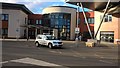
Peterborough City Care Centre
The City Care Centre, which is located on St. John's Close off Thorpe Road, opened in May 2009. Its services include an outpatient diagnostic and treatment centre (walk-in clinic), specialist rehabilitation beds and general rehabilitation services, a children's care centre and a pharmacy. The City Care Centre was built on the site of a wing of the former Peterborough District Hospital, which was decommissioned in 2010 when the Peterborough City Hospital in Bretton Gate became operational. The former District Hospital was demolished in 2015.
UPDATE: The urgent treatment centre (walk-in clinic) was transferred from the City Care Centre to Peterborough City Hospital in Bretton Gate with effect from July 2021.
Sources: https://en.wikipedia.org/wiki/Peterborough_District_Hospital
https://www.uos.ac.uk/content/peterborough-and-stamford-nhs-foundation-trust
https://www.peterboroughtoday.co.uk/health/excitement-as-peterboroughs-new-walk-in-centre-opens-3293051
Image: © Paul Bryan
Taken: 3 Nov 2018
0.15 miles