
IMAGES TAKEN NEAR TO
Peddars Way North, HUNSTANTON, PE36 5JP
Introduction
This page details the photographs taken nearby to Peddars Way North, PE36 5JP by members of the Geograph project.
The Geograph project started in 2005 with the aim of publishing, organising and preserving representative images for every square kilometre of Great Britain, Ireland and the Isle of Man.

There are currently over 7.5m images from over14,400 individuals and you can help contribute to the project by visiting https://www.geograph.org.uk
Image Map
Images are licensed for reuse under creativecommons.org/licenses/by-sa/2.0
Notes
- Clicking on the map will re-center to the selected point.
- The higher the marker number, the further away the image location is from the centre of the postcode.
Image Listing (13 Images Found)
Images are licensed for reuse under creativecommons.org/licenses/by-sa/2.0
Image
Details
Distance
1

Old windmill at Mill Farm Ringstead
From the road named Peddars Way North, and this section is indeed on the Peddars Way National Trail. The windmill was built 1837-42 unusually it featured six sails, in Norfolk most had four. It operated until 1897 and was then converted in 1927 to residential use as it is today
Image: © Martin Dawes
Taken: 12 Sep 2018
0.09 miles
2
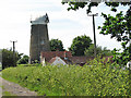
Ringstead tower mill
Viewed from > http://www.geograph.org.uk/photo/837421.
Ringstead towermill is six storeys high and built of brick which has been tarred; it once had six sails, a quite unusual feature for Norfolk mills. Built around 1850 by Henry L'Strange Styleman le Strange, it had a boat shaped cap and a stage on the second floor. Located at the end of a track off Peddars Way North, north of the village, the mill was converted to domestic use in 1927.
Image: © Evelyn Simak
Taken: 8 Jun 2008
0.09 miles
3

The disused mill at Great Ringstead
Not entirely disused, but disused as a mill and certainly not derelict.
Image: © Adrian S Pye
Taken: 15 Jun 2015
0.09 miles
4

View across field beside Peddars Way North
The view is westerly, towards Ringstead tower mill and Mill Farm.
Ringstead towermill is six storeys high and built of brick which has been tarred; it once had six sails, a quite unusual feature for Norfolk mills. Built around 1850 by Henry L'Strange Styleman le Strange, it had a boat shaped cap and a stage on the second floor. Located at the end of a track off Peddars Way North, north of the village, the mill was converted to domestic use in 1927.
Image: © Evelyn Simak
Taken: 8 Jun 2008
0.09 miles

6

Ringstead tower mill
Long distance view across fields.
Image: © JThomas
Taken: 17 Oct 2017
0.10 miles
7
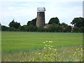
Mill tower north of Ringstead
Part of Mill Farm on the western side of the Peddars' Way near Hunstanton in north west Norfolk
Image: © Richard Humphrey
Taken: 13 Jun 2010
0.11 miles
8

Peddars Way North
Exiting the village of Ringstead. This quiet country lane connects with the A149 (Main Road) in Holme-next-the-Sea, further to the north. See > http://www.geograph.org.uk/photo/837421 for a view taken in the opposite direction.
Image: © Evelyn Simak
Taken: 8 Jun 2008
0.12 miles
9
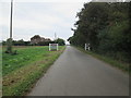
Entering Ringstead from the north on Peddars Way
Having just come over field footpaths the Peddars Way National Trail now follows the road called Peddars Way into Ringstead village
Image: © Martin Dawes
Taken: 12 Sep 2018
0.12 miles
10

Windmill near Ringstead
Former windmill at Mill Farm near Ringstead.
Image: © Philip Halling
Taken: 11 Jul 2006
0.13 miles