
IMAGES TAKEN NEAR TO
Burrells Meadow, KING'S LYNN, PE32 2TL
Introduction
This page details the photographs taken nearby to Burrells Meadow, PE32 2TL by members of the Geograph project.
The Geograph project started in 2005 with the aim of publishing, organising and preserving representative images for every square kilometre of Great Britain, Ireland and the Isle of Man.

There are currently over 7.5m images from over14,400 individuals and you can help contribute to the project by visiting https://www.geograph.org.uk
Image Map
Images are licensed for reuse under creativecommons.org/licenses/by-sa/2.0
Notes
- Clicking on the map will re-center to the selected point.
- The higher the marker number, the further away the image location is from the centre of the postcode.
Image Listing (49 Images Found)
Images are licensed for reuse under creativecommons.org/licenses/by-sa/2.0
Image
Details
Distance
5
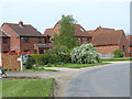
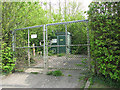
Entrance to Site 8
Site 8, situated in the heart of the village of Beeston, was one of the Accommodation sites of RAF Wendling which was an active airfield during WW2.
Image: © Evelyn Simak
Taken: 16 Feb 2016
0.06 miles
6

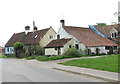
Racecourse Farmhouse, Beeston
The farmhouse adjoins the former Site 8, one of the accommodation sites of RAF Wendling which was an active airfield during WW2.
Image: © Evelyn Simak
Taken: 16 Feb 2016
0.08 miles
7

Racecourse Farmhouse
As seen from Site 8. Site 8 was one of the Accommodation sites of RAF Wendling which was an active airfield during WW2 and Race Course Farm was still a working farm. The airmen housen on Site 8 often helped out on the farm and returned with supplies of eggs and fresh milk.
Image: © Evelyn Simak
Taken: 16 Feb 2016
0.08 miles
8

Air raid shelter fish pond
On the former Site 8. Site 8 was one of the Accommodation sites of RAF Wendling which was an active airfield during WW2 and Race Course Farm was still a working farm. This air raid shelter has since been turned into a fish pond by cutting out a section of its concrete roof.
Image: © Evelyn Simak
Taken: 16 Feb 2016
0.08 miles
9

Air raid shelter on Site 8
Site 8 was one of the Accommodation sites of RAF Wendling which was an active airfield during WW2. This air raid shelter has since been turned into a fish pond by cutting out a section of its concrete roof.
Image: © Evelyn Simak
Taken: 16 Feb 2016
0.08 miles
10

Beeston village sign
The B-24 Liberator bomber aircraft flying over Beeston St Mary's church > http://www.geograph.org.uk/photo/1830393 is a reminder of the village's WW2 history when nearby RAF Wendling was an active airfield. For a full view of the village sign see > http://www.geograph.org.uk/photo/3943127.
Image: © Evelyn Simak
Taken: 2 Feb 2016
0.08 miles