
IMAGES TAKEN NEAR TO
Rougham, KING'S LYNN, PE32 2SG
Introduction
This page details the photographs taken nearby to PE32 2SG by members of the Geograph project.
The Geograph project started in 2005 with the aim of publishing, organising and preserving representative images for every square kilometre of Great Britain, Ireland and the Isle of Man.

There are currently over 7.5m images from over14,400 individuals and you can help contribute to the project by visiting https://www.geograph.org.uk
Image Map
Images are licensed for reuse under creativecommons.org/licenses/by-sa/2.0
Notes
- Clicking on the map will re-center to the selected point.
- The higher the marker number, the further away the image location is from the centre of the postcode.
Image Listing (38 Images Found)
Images are licensed for reuse under creativecommons.org/licenses/by-sa/2.0
Image
Details
Distance
1
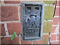
Ordnance Survey Flush Bracket G2968
This can be found on the wall of a house - private dwelling - at Squinney Plantation.
For more detail see : http://www.bench-marks.org.uk/bm12719
Image: © Peter Wood
Taken: 9 Nov 2014
0.01 miles
2

Road at Squinney Plantation
Looking eastward.
Image: © Peter Wood
Taken: 9 Nov 2014
0.02 miles
3

Country lane west of Rougham in Norfolk
Looking towards Squinney Plantation and the B1145
Image: © Richard Humphrey
Taken: 8 Dec 2014
0.02 miles


6

Grove of Trees
Looking north, on eastern edge of grid square, towards The Hall Rougham Norfolk. The North family have occupied The Hall for several centuries and former family members are commemorated it the nearby Rougham Church.
Image: © Dennis Turner
Taken: 27 Oct 2004
0.15 miles

9

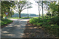
Road direction sign
Road direction sign near to Rougham Norfolk.
Image: © Keith Evans
Taken: 6 Jul 2008
0.20 miles
10

Wet road junction
Looking south west with a junction onto the B1145 and a farm road the other side near to Rougham, Norfolk.
Image: © Keith Evans
Taken: 6 Jul 2008
0.20 miles