
IMAGES TAKEN NEAR TO
Chapel Lane, KING'S LYNN, PE32 2NG
Introduction
This page details the photographs taken nearby to Chapel Lane, PE32 2NG by members of the Geograph project.
The Geograph project started in 2005 with the aim of publishing, organising and preserving representative images for every square kilometre of Great Britain, Ireland and the Isle of Man.

There are currently over 7.5m images from over14,400 individuals and you can help contribute to the project by visiting https://www.geograph.org.uk
Image Map
Images are licensed for reuse under creativecommons.org/licenses/by-sa/2.0
Notes
- Clicking on the map will re-center to the selected point.
- The higher the marker number, the further away the image location is from the centre of the postcode.
Image Listing (41 Images Found)
Images are licensed for reuse under creativecommons.org/licenses/by-sa/2.0
Image
Details
Distance
1

Beeston Village General Stores and ..
Post Office and off-licence. Well located and advertised in local villages with signs on roads. Opposite the village school Image and the sign for Image
Image: © Zorba the Geek
Taken: 11 Aug 2007
0.03 miles
2

K6 telephone kiosk by the former Post Office
Image: © Evelyn Simak
Taken: 21 Apr 2014
0.07 miles
3

Disused George V postbox
In the wall of the former Beeston Village General Stores and Post Office, now closed.
Image: © Evelyn Simak
Taken: 21 Apr 2014
0.08 miles
4

The former Beeston Village General Stores and Post Office
Image: © Evelyn Simak
Taken: 21 Apr 2014
0.08 miles

6
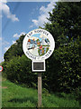
EDP Village of the Year 2005: Beeston
Centrally located in this pretty village, a sign of community pride.
Image: © Zorba the Geek
Taken: 11 Aug 2007
0.08 miles
7

Dereham Road/Syers Lane junction
The building seen at left used to be the Beeston Village General Stores and Post Office > http://www.geograph.org.uk/photo/522988.
Image: © Evelyn Simak
Taken: 21 Apr 2014
0.08 miles
8
Beeston-next Mileham village sign
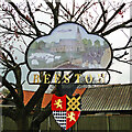
The sign takes the form of a cloud as used on a weather map. It depicts the church of St Mary and above it a B24 Liberator which used to fly from RAF Wendling during the Second World War. Although the airfield was more in Beeston it was named Wendling to avoid confusion with other parishes of the same name. It was under USAAF control, designated as Station 118. The rest of the picture is a more restful pastoral scene with a shepherd and his flock and a pair of horses ploughing. The coat of arms is that of the FitzAlan d'Arundel dynasty with a chequy in the 3rd quarter. https://www.geograph.org.uk/photo/6813347
Image: © Adrian S Pye
Taken: 20 Apr 2021
0.09 miles
9

Flowering tree on Beeston village green
For a wider view of this location see > http://www.geograph.org.uk/photo/3943127.
Image: © Evelyn Simak
Taken: 21 Apr 2014
0.09 miles
10
Beeston-next Mileham village sign
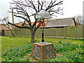
The sign takes the form of a cloud as used on a weather map. It depicts the church of St Mary and above it a B24 Liberator which used to fly from RAF Wendling during the Second World War. Although the airfield was more in Beeston it was named Wendling to avoid confusion with other parishes of the same name. It was under USAAF control, designated as Station 118. The rest of the picture is a more restful pastoral scene with a shepherd and his flock and a pair of horses ploughing. The coat of arms is that of the FitzAlan d'Arundel dynasty with a chequy in the 4th quarter. https://www.geograph.org.uk/photo/6813343
Image: © Adrian S Pye
Taken: 20 Apr 2021
0.09 miles