
IMAGES TAKEN NEAR TO
Holt House Lane, KING'S LYNN, PE32 1EL
Introduction
This page details the photographs taken nearby to Holt House Lane, PE32 1EL by members of the Geograph project.
The Geograph project started in 2005 with the aim of publishing, organising and preserving representative images for every square kilometre of Great Britain, Ireland and the Isle of Man.

There are currently over 7.5m images from over14,400 individuals and you can help contribute to the project by visiting https://www.geograph.org.uk
Image Map
Images are licensed for reuse under creativecommons.org/licenses/by-sa/2.0
Notes
- Clicking on the map will re-center to the selected point.
- The higher the marker number, the further away the image location is from the centre of the postcode.
Image Listing (8 Images Found)
Images are licensed for reuse under creativecommons.org/licenses/by-sa/2.0
Image
Details
Distance
1
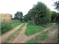
Straw left - sand right
Farming on the left and a sand quarry on the right. Between Leziate and Ashwicken
Image: © Richard Humphrey
Taken: 3 Sep 2010
0.14 miles
2
Farmland at Leziate off Holthouse Lane
Image: © Adrian S Pye
Taken: 30 Nov 2018
0.15 miles
3
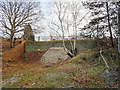
Bridge over quarry track
This bridge carries Station Road over a track that connects a quarry pit to the quarry base.
The yellow sign on the bridge indicates that a conveyor belt used to run under the bridge.
Image: © Martin Pearman
Taken: 4 Jan 2017
0.17 miles
4
Flooded track between Leziate and Ashwicken
Image: © Richard Humphrey
Taken: 3 Sep 2010
0.18 miles
5
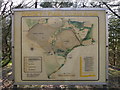
Public Access Areas
A grubby old map displays paths and access areas at Bawsey Country Park.
Image: © Martin Pearman
Taken: 6 Mar 2015
0.21 miles
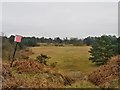
7
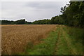
Wheat, track, and woodland near Leziate
The track is a public path along the side of the field. A thin strip of woodland divides it from the next field along.
Image: © Ben Harris
Taken: 2 Sep 2007
0.22 miles
8
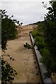
Sand conveyor, King's Lynn quarry
The conveyor crosses under the road, from the sand pits on one side to the processing plants on the other.
Image: © Ben Harris
Taken: 18 Aug 2007
0.23 miles