
IMAGES TAKEN NEAR TO
Tattersett, KING'S LYNN, PE31 8RU
Introduction
This page details the photographs taken nearby to PE31 8RU by members of the Geograph project.
The Geograph project started in 2005 with the aim of publishing, organising and preserving representative images for every square kilometre of Great Britain, Ireland and the Isle of Man.

There are currently over 7.5m images from over14,400 individuals and you can help contribute to the project by visiting https://www.geograph.org.uk
Image Map
Images are licensed for reuse under creativecommons.org/licenses/by-sa/2.0
Notes
- Clicking on the map will re-center to the selected point.
- The higher the marker number, the further away the image location is from the centre of the postcode.
Image Listing (5 Images Found)
Images are licensed for reuse under creativecommons.org/licenses/by-sa/2.0
Image
Details
Distance
1
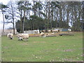
Ewes and lambs, Highfield House near Tattersett
Image: © Nigel Jones
Taken: 30 Mar 2007
0.06 miles
2
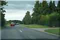
Still heavy clouds but no rain
We are waiting for the rain to come back as we drive along the road.
Image: © Malcolm Neal
Taken: 5 Aug 2019
0.07 miles
3
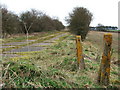
Concrete posts and a disused road
This old road north west of Tattersett was probably cut off and made redundant when several roads in the area were re-routed to accommodate the construction of Sculthorpe Airfield
Image: © Richard Humphrey
Taken: 18 Mar 2011
0.12 miles
4
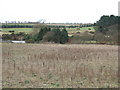
The valley of the River Tat
Between Syderstone and Tattersett in Norfolk. The trees on the right are Coxford Heath
Image: © Richard Humphrey
Taken: 18 Mar 2011
0.17 miles
5
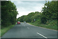
One car turning off the road
The car coming towards us is turning onto the road to Syderstone.
Image: © Malcolm Neal
Taken: 5 Aug 2019
0.23 miles