
IMAGES TAKEN NEAR TO
Lynn Road, KING'S LYNN, PE31 8RN
Introduction
This page details the photographs taken nearby to Lynn Road, PE31 8RN by members of the Geograph project.
The Geograph project started in 2005 with the aim of publishing, organising and preserving representative images for every square kilometre of Great Britain, Ireland and the Isle of Man.

There are currently over 7.5m images from over14,400 individuals and you can help contribute to the project by visiting https://www.geograph.org.uk
Image Map
Images are licensed for reuse under creativecommons.org/licenses/by-sa/2.0
Notes
- Clicking on the map will re-center to the selected point.
- The higher the marker number, the further away the image location is from the centre of the postcode.
Image Listing (19 Images Found)
Images are licensed for reuse under creativecommons.org/licenses/by-sa/2.0
Image
Details
Distance
1

Old Milestone by the A148, West Rudham
Carved stone post by the A148, in parish of West Rudham (Kings Lynn and West Norfolk District), opposite drive between "Rosedean" and "Albion House", at edge of village green about 1ft from edge of road, on South side of road. Wells stone, erected by the Wells to Fakenham turnpike trust in the 20th century.
Inscription reads:-
: TO / LYNN / 14 : : W RUDHAM : : TO / FAKENHAM / 7 :
Norfolk HER.
NHER Number: 56751 https://www.heritagegateway.org.uk/Gateway/Results_Single.aspx?uid=MNF63162&resourceID=1002
Milestone Society National ID: NO_FKL07
Image: © CW Haines
Taken: 19 Jun 2002
0.02 miles
2

Entering West Rudham on the A148
Village green coming up on the left
Image: © Martin Dawes
Taken: 20 Apr 2019
0.03 miles
3

West Rudham looking north
Western edge of West Rudham viewed from near St Peter's church
Image: © Nigel Jones
Taken: 4 Apr 2007
0.03 miles

5

West Rudham Village Sign and Village Green
Looking east along the village green with the A148, King's Lynn to Cromer road, to the left of the green.
Image: © G Laird
Taken: 26 Oct 2017
0.06 miles

7
West Rudham village sign
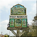
The sign is headed by a horseshoe and ears of wheat, stressing the importance of the agricultural heritage to the village. The church of St Peter is included in the upper panel which also depicts a man and horse ploughing the land. Below the name is and oak tree beside a stream presenting the peaceful nature of the village, flanked by a Saxon complete with shield, sword and spear and a Roman soldier similarly equipped for battle. The sign is double sided but both sides are virtually identical in all but minor details. https://www.geograph.org.uk/photo/6815234
Image: © Adrian S Pye
Taken: 20 Apr 2021
0.07 miles
8
West Rudham village sign
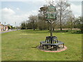
The sign is headed by a horseshoe and ears of wheat, stressing the importance of the agricultural heritage to the village. The church of St Peter is included in the upper panel which also depicts a man and horse ploughing the land. Below the name is and oak tree beside a stream presenting the peaceful nature of the village, flanked by a Saxon complete with shield, sword and spear and a Roman soldier similarly equipped for battle. The sign is double sided but both sides are virtually identical in all but minor details. https://www.geograph.org.uk/photo/6815231
Image: © Adrian S Pye
Taken: 20 Apr 2021
0.07 miles

