
IMAGES TAKEN NEAR TO
Main Road, KING'S LYNN, PE31 8ED
Introduction
This page details the photographs taken nearby to Main Road, PE31 8ED by members of the Geograph project.
The Geograph project started in 2005 with the aim of publishing, organising and preserving representative images for every square kilometre of Great Britain, Ireland and the Isle of Man.

There are currently over 7.5m images from over14,400 individuals and you can help contribute to the project by visiting https://www.geograph.org.uk
Image Map
Images are licensed for reuse under creativecommons.org/licenses/by-sa/2.0
Notes
- Clicking on the map will re-center to the selected point.
- The higher the marker number, the further away the image location is from the centre of the postcode.
Image Listing (36 Images Found)
Images are licensed for reuse under creativecommons.org/licenses/by-sa/2.0
Image
Details
Distance
1
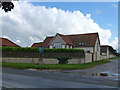
Titchwell, Norfolk
The village sign stands outside these converted farm buildings on the main coastal road, A149
Image: © Richard Humphrey
Taken: 5 Aug 2012
0.03 miles
2

Titchwell village sign
The sign depicts three tankards, presumably representing public houses, one of which was The Three Horseshoes. The first of the three arms I cannot identify, those in the centre are of Magdalen College, Oxford, the third is of Eton College Cambridge, both landowners in their time. The avocet represents the RSPB reserve, the parish church of St Mary, two tractors represent the farms hereabouts. The crab could represent the crabs caught, or the sea itself which is less than a mile away from this sign. https://www.geograph.org.uk/photo/6815202
Image: © Adrian S Pye
Taken: 31 Mar 2021
0.03 miles
3

Titchwell village sign
The sign depicts three tankards, presumably representing public houses, one of which was The Three Horseshoes. The first of the three arms I cannot identify, those in the centre are of Magdalen College, Oxford, the third is of Eton College Cambridge, both landowners in their time. The avocet represents the RSPB reserve, the parish church of St Mary, two tractors represent the farms hereabouts. The crab could represent the crabs caught, or the sea itself which is less than a mile away from this sign. https://www.geograph.org.uk/photo/6815203
Image: © Adrian S Pye
Taken: 31 Mar 2021
0.03 miles
4

Village sign
The village sign at Titchwell, Norfolk
Image: © Craig Tuck
Taken: 5 Jul 2009
0.03 miles

6

A149 at Titchwell
The sea is only a short distance to the right.
Image: © J.Hannan-Briggs
Taken: 15 Jun 2016
0.05 miles

8

In Focus, Titchwell
Binocular, telescope and bird books shop near the RSPB reserve (which also sells similar things).
Image: © Hugh Venables
Taken: 18 Jun 2016
0.07 miles
9

Titchwell village
Western end. The effect of the very popular Titchwell RSPB reserve on the services in Titchwell village is very obvious - a birdwatching optics shop and two hotels. There are local shops in the villages to the east and west.
Image: © Hugh Venables
Taken: 23 Aug 2008
0.07 miles
