
IMAGES TAKEN NEAR TO
The Close, KING'S LYNN, PE31 8BS
Introduction
This page details the photographs taken nearby to The Close, PE31 8BS by members of the Geograph project.
The Geograph project started in 2005 with the aim of publishing, organising and preserving representative images for every square kilometre of Great Britain, Ireland and the Isle of Man.

There are currently over 7.5m images from over14,400 individuals and you can help contribute to the project by visiting https://www.geograph.org.uk
Image Map
Images are licensed for reuse under creativecommons.org/licenses/by-sa/2.0
Notes
- Clicking on the map will re-center to the selected point.
- The higher the marker number, the further away the image location is from the centre of the postcode.
Image Listing (183 Images Found)
Images are licensed for reuse under creativecommons.org/licenses/by-sa/2.0
Image
Details
Distance
1

The Close, Brancaster Staithe
With house building ongoing at the far end.
Image: © Hugh Venables
Taken: 22 Nov 2019
0.01 miles
2
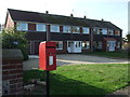
Elizabeth II postbox and houses on the A149, Brancaster Staithe
Postbox No. PE31 133.
See Image] for postbox.
Image: © JThomas
Taken: 17 Oct 2017
0.03 miles
3
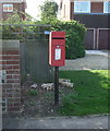
Elizabeth II postbox on the A149, Brancaster Staithe
Image: © JThomas
Taken: 17 Oct 2017
0.04 miles
4
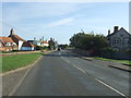
A149, Brancaster Staithe
Looking east showing position of Postbox No. PE31 133.
See Image] for postbox.
Image: © JThomas
Taken: 17 Oct 2017
0.04 miles
5

Fenced off house by A149
Due for demolition and, presumably, replaced by considerably higher density housing.
Image: © Hugh Venables
Taken: 22 Nov 2019
0.06 miles
6

Brancaster Staithe
One of the main centres for sailing on the North Norfolk coast.
Image: © Hugh Venables
Taken: 23 Aug 2008
0.06 miles
7

Town Lane, Brancaster Staithe
With the first plot due for redevelopment.
Image: © Hugh Venables
Taken: 22 Nov 2019
0.07 miles
8

Village sign, Brancaster Staithe
A natural wood, unpainted sign at the harbour entrance.
Image: © Pauline E
Taken: 12 Sep 2014
0.07 miles
9

Brancaster Staithe village sign
In the semi-circular carving above the name is a small fishing boat, the like of which used to seek a living for their owners, out at sea. Each spandrels is decorated with a whelk shell, a reminder of the whelk fishermen who also sailed out of Brancaster Staithe in search of their catch. https://www.geograph.org.uk/photo/6793649
Image: © Adrian S Pye
Taken: 31 Mar 2021
0.07 miles
10

Brancaster Staithe village sign
In the semi-circular carving above the name is a small fishing boat, the like of which used to seek a living for their owners, out at sea. Each spandrels is decorated with a whelk shell, a reminder of the whelk fishermen who also sailed out of Brancaster Staithe in search of their catch. https://www.geograph.org.uk/photo/6793648
Image: © Adrian S Pye
Taken: 31 Mar 2021
0.07 miles