
IMAGES TAKEN NEAR TO
Shepherds Port Road, KING'S LYNN, PE31 7UT
Introduction
This page details the photographs taken nearby to Shepherds Port Road, PE31 7UT by members of the Geograph project.
The Geograph project started in 2005 with the aim of publishing, organising and preserving representative images for every square kilometre of Great Britain, Ireland and the Isle of Man.

There are currently over 7.5m images from over14,400 individuals and you can help contribute to the project by visiting https://www.geograph.org.uk
Image Map
Images are licensed for reuse under creativecommons.org/licenses/by-sa/2.0
Notes
- Clicking on the map will re-center to the selected point.
- The higher the marker number, the further away the image location is from the centre of the postcode.
Image Listing (60 Images Found)
Images are licensed for reuse under creativecommons.org/licenses/by-sa/2.0
Image
Details
Distance
1

Footpath to RSPB Reserve, Snettisham, Norfolk
The RSPB Reserve contains a variety of habitats - lakes, scrub land, beach etc.
Image: © Christine Matthews
Taken: 15 May 2012
0.08 miles
2

Coasting out over the Wash north of Shepherd's Port: aerial 2015
Snettisham Scalp is on the shoreline by the caravan park.
Kept at 500 feet for some distance on account of the jets flying in and out of R.A.F. Marham, the little Cessna 150 was still well short of target of the 5,000 feet, which would hopefully allow it to reach the coast on one side or the other of the Wash in the event of engine failure.
Image: © Chris
Taken: 20 May 2015
0.08 miles
3

Shepherd's Lake
Part of a lake behind Snettisham Beach which is part of Snettisham Nature Reserve.
Image: © Bill Boaden
Taken: 5 Sep 2019
0.08 miles
4

Shepherd's Port, Snettisham, Norfolk
Lake near Shepherd's Port.
Image: © Christine Matthews
Taken: 15 May 2012
0.09 miles
5

Shepherd's Port, Snettisham, Norfolk
As seen from the footpath to the RSPB Reserve.
Image: © Christine Matthews
Taken: 15 May 2012
0.09 miles
6

Shepherd's Port fishing ponds, Snettisham Norfolk
Near the car park for the RSPB site.
Image: © Steve Fareham
Taken: 11 Mar 2012
0.09 miles
7

Shepherds Port Fishery at Snettisham
A view of the Shepherds Lake at Shepherds Port Fishery.
Image: © Martin Pearman
Taken: 27 Sep 2006
0.09 miles
8

Shepherd's Port fishery, Snettisham, Norfolk
Image: © Richard Humphrey
Taken: 15 Jun 2010
0.11 miles
9

Lake and Scrub Land, Snettisham, Norfolk
Image: © Christine Matthews
Taken: 15 May 2012
0.11 miles
10
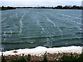
Choppy waters on the lake between Snettisham Beach and Shepherd's Port, Norfolk
Image: © Richard Humphrey
Taken: 8 Jun 2017
0.12 miles