
IMAGES TAKEN NEAR TO
St. Thomas's Lane, KING'S LYNN, PE31 6SR
Introduction
This page details the photographs taken nearby to St. Thomas's Lane, PE31 6SR by members of the Geograph project.
The Geograph project started in 2005 with the aim of publishing, organising and preserving representative images for every square kilometre of Great Britain, Ireland and the Isle of Man.

There are currently over 7.5m images from over14,400 individuals and you can help contribute to the project by visiting https://www.geograph.org.uk
Image Map
Images are licensed for reuse under creativecommons.org/licenses/by-sa/2.0
Notes
- Clicking on the map will re-center to the selected point.
- The higher the marker number, the further away the image location is from the centre of the postcode.
Image Listing (69 Images Found)
Images are licensed for reuse under creativecommons.org/licenses/by-sa/2.0
Image
Details
Distance
1

Houses in Ingoldisthorpe
This pair of semi detached houses sit in the centre of the village close to the crossroads. They are constructed out of local stone much of which is the dark treacle brown carrstone, which can also be seen in the garden wall.
Image: © Nigel Mykura
Taken: 13 Sep 2012
0.00 miles
2

Warren Farm
On Brickley Lane, Ingoldisthorpe.
Image: © Phil Champion
Taken: 23 Feb 2011
0.01 miles
3

Kissing gate off St Thomas's Lane, Ingoldisthorpe
From here a footpath runs downhill to the River Ingol, and thence on to Snettisham
Image: © Phil Champion
Taken: 23 Feb 2011
0.04 miles
4
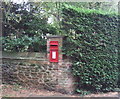
Elizabeth II postbox on Brickley Lane, Ingoldisthorpe
Postbox No. PE31 78.
Image: © JThomas
Taken: 20 Oct 2017
0.09 miles
5

Wall box at the junction of Chalk Pit Road and Brickley Lane, Ingoldisthorpe
Image: © Phil Champion
Taken: 23 Feb 2011
0.09 miles
6

Towards St Michaels, Ingoldisthorpe
The parish church is tucked away behind residential gardens and tall trees.
Image: © Phil Champion
Taken: 23 Feb 2011
0.10 miles
7

Bench Mark at Ingoldisthorpe church
The bench Mark is on the north-west buttress of the tower of St Michael's church, facing south-west, approximately 1 metre from ground level at TF 69054 32769. More information can be found on the Bench Mark database. http://www.bench-marks.org.uk/bm31982
Image: © Adrian S Pye
Taken: 2 Jul 2010
0.10 miles
8

Trees with a view
The Wash is almost imperceptible in the distant mist. The rooftops of Ingoldisthorpe are at the bottom of the hill.
Image: © David Martin
Taken: 30 Jul 2024
0.10 miles
9

Permissive bridleway alongside St Thomas's Lane, Ingoldisthorpe
Image: © Phil Champion
Taken: 23 Feb 2011
0.10 miles
10

Old preaching cross in Ingoldisthorpe churchyard
Mostly erected during the medieval period (mid 10th to mid 16th centuries AD).
Standing crosses served a variety of functions. In churchyards they served as
stations for outdoor processions, particularly in the observance of Palm
Sunday. Elsewhere, standing crosses were used within settlements as places for
preaching, public proclamation and penance, as well as defining rights of
sanctuary.
Image: © Adrian S Pye
Taken: 2 Jul 2010
0.10 miles