
IMAGES TAKEN NEAR TO
Milton Avenue, KING'S LYNN, PE30 2QQ
Introduction
This page details the photographs taken nearby to Milton Avenue, PE30 2QQ by members of the Geograph project.
The Geograph project started in 2005 with the aim of publishing, organising and preserving representative images for every square kilometre of Great Britain, Ireland and the Isle of Man.

There are currently over 7.5m images from over14,400 individuals and you can help contribute to the project by visiting https://www.geograph.org.uk
Image Map
Images are licensed for reuse under creativecommons.org/licenses/by-sa/2.0
Notes
- Clicking on the map will re-center to the selected point.
- The higher the marker number, the further away the image location is from the centre of the postcode.
Image Listing (89 Images Found)
Images are licensed for reuse under creativecommons.org/licenses/by-sa/2.0
Image
Details
Distance


3
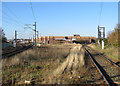
King's Lynn: once a much busier railway
A view from Tennyson Avenue level crossing towards King's Lynn Station (in the distance on the left) and the superstores which have replaced the steam locomotive depot and a lot of goods sidings. The former Docks Branch - now truncated - curves away to the right. Behind the camera King's Lynn Junction Signal Box once controlled lines to Hunstanton and Dereham as well as the main line to Cambridge and King's Cross.
Image: © John Sutton
Taken: 18 Nov 2018
0.10 miles
4

Kings Lynn
Having run around its train, 37023 departs the sidings at Kings Lynn with a load of sand for the Rockware glass factory near Knottingley. Kings Lynn station is visible on the left.
Image: © Martin Addison
Taken: Unknown
0.11 miles
5

Steam at King's Lynn
A zoom assisted picture of Black 5 44932 pulling coaches from the sidings in preparation to reverse into the station for the final day of the Great Britain XV rail tour.
Image: © Tim Glover
Taken: 23 Apr 2023
0.12 miles
6

Railway track approaching King's Lynn station
Image: © Richard Humphrey
Taken: 21 Mar 2021
0.12 miles

8

King's Lynn Stabling Point
03175 shares the stabling point with 08205 (inside the shed) and 37107 on a misty January day. The stabling point, along with the extensive sidings on the north side of the station, has since disappeared being no longer required.
Image: © Martin Addison
Taken: 12 Jan 1980
0.12 miles

10

Entrance to the Sandringham Railway Path
The disused railway track also carries Cycle Route 1 for about two miles, from the centre to the north side of King's Lynn
Image: © Tim Heaton
Taken: 8 Apr 2017
0.13 miles