
IMAGES TAKEN NEAR TO
King George V Avenue, KING'S LYNN, PE30 2QD
Introduction
This page details the photographs taken nearby to King George V Avenue, PE30 2QD by members of the Geograph project.
The Geograph project started in 2005 with the aim of publishing, organising and preserving representative images for every square kilometre of Great Britain, Ireland and the Isle of Man.

There are currently over 7.5m images from over14,400 individuals and you can help contribute to the project by visiting https://www.geograph.org.uk
Image Map
Images are licensed for reuse under creativecommons.org/licenses/by-sa/2.0
Notes
- Clicking on the map will re-center to the selected point.
- The higher the marker number, the further away the image location is from the centre of the postcode.
Image Listing (18 Images Found)
Images are licensed for reuse under creativecommons.org/licenses/by-sa/2.0
Image
Details
Distance
1

WW2 Memorial at King Edward VII school, King's Lynn
The Memorial bears 71 names of alumni who lost their life in the Second World War
Image: © Adrian S Pye
Taken: 30 Nov 2018
0.06 miles
2

WW1 Memorial at King Edward VII school, King's Lynn
The memorial bears 56 names of alumni who lost their life in the Great War.
Image: © Adrian S Pye
Taken: 30 Nov 2018
0.06 miles
3

His Majesty King Edward VII
A bronze likeness at the school in King's Lynn which bears his name.
Image: © Adrian S Pye
Taken: 30 Nov 2018
0.08 miles
4
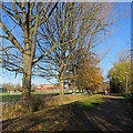
King's Lynn: on Sandringham Railway Path
The path, part of National Cycle Network Route 1, follows the course of the King's Lynn to Hunstanton Railway, which closed in 1969. King Edward VII Academy (formerly Grammar School) shows in the distance on the far side of its playing fields.
Image: © John Sutton
Taken: 18 Nov 2018
0.14 miles
5
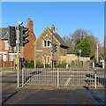
King's Lynn: where trains once crossed
This is where the Sandringham Railway Path crosses Gaywood Road. Until 1969 this was the route of the Lynn to Hunstanton railway and the house in the centre was a crossing-keeper's cottage.
Image: © John Sutton
Taken: 18 Nov 2018
0.17 miles
6

Footpath and cycleway off Lynn Road, Gaywood
A multi use path on the trackbed of the former railway line from King's Lynn towards Hunstanton and Wells. Looking towards North Wootton from what would have been a level crossing across Lynn Road.
Image: © Richard Vince
Taken: 20 Sep 2025
0.18 miles

8

Part of The College Of West Anglia demolished
Image: © Alex McGregor
Taken: 14 Jun 2011
0.19 miles
9
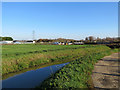
King's Lynn: Gaywood River and allotments
A November-morning view from the path from Loke Road.
Image: © John Sutton
Taken: 18 Nov 2018
0.21 miles
