
IMAGES TAKEN NEAR TO
Smith Avenue, KING'S LYNN, PE30 2BQ
Introduction
This page details the photographs taken nearby to Smith Avenue, PE30 2BQ by members of the Geograph project.
The Geograph project started in 2005 with the aim of publishing, organising and preserving representative images for every square kilometre of Great Britain, Ireland and the Isle of Man.

There are currently over 7.5m images from over14,400 individuals and you can help contribute to the project by visiting https://www.geograph.org.uk
Image Map
Images are licensed for reuse under creativecommons.org/licenses/by-sa/2.0
Notes
- Clicking on the map will re-center to the selected point.
- The higher the marker number, the further away the image location is from the centre of the postcode.
Image Listing (20 Images Found)
Images are licensed for reuse under creativecommons.org/licenses/by-sa/2.0
Image
Details
Distance
1

King's Lynn: Columbia Way
Post war houses on the north side of the town.
Image: © John Sutton
Taken: 18 Nov 2018
0.10 miles
2

Rope Walk
A private drive in North Lynn.
Image: © Burgess Von Thunen
Taken: 3 May 2012
0.13 miles
3

King's Lynn: the truncated Docks Branch
Rail traffic to the docks ceased in 1994 and the line has been abandoned north of here. This is a view over the bridge parapet from Gaywood Road.
Image] is a view south-east of Gaywood Road.
Image: © John Sutton
Taken: 18 Nov 2018
0.15 miles
4
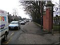
Busy road outside King Edward VII School
Image: © Alan Parkinson
Taken: Unknown
0.16 miles
5

King's Lynn to docks branch line
End of the King's Lynn to King's Lynn docks line line now used as a turnaround point for the Middleton Towers sand trains. Taken from Dodman's Bridge near the college.
Image: © andrew watts
Taken: 28 Jun 2020
0.17 miles
6
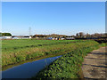
King's Lynn: Gaywood River and allotments
A November-morning view from the path from Loke Road.
Image: © John Sutton
Taken: 18 Nov 2018
0.17 miles
7

King's Lynn Docks Branch
The line to the docks closed beyond Gaywood Road in 1994. The remaining sidings between here and King's Lynn Junction were used to enable sand trains from Middleton Towers to reverse. The tall building in the distance is part of the College of West Anglia. The gable end on the left is made of carstone, the local sandstone.
Image] is a view north-west from Gaywood Road bridge.
Image: © John Sutton
Taken: 18 Nov 2018
0.20 miles
8
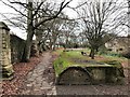
Wartime air raid shelter, Kettlewell Lane, King's Lynn
This concrete shelter, built during World War 2 in a small recreation ground between the Gaywood River and the old city walls on Kettlewell Lane had space for 100 people according to www.heritage.norfolk.gov.uk/record-details?MNF31205-World-War-Two-air-raid-shelter-Kettlewell-Recreation-Ground&Index=28440&RecordCount=57339&SessionID=9e8d76ab-afdf-490b-b55a-8f28f36a1a43
Image: © Richard Humphrey
Taken: 5 Jan 2020
0.20 miles
9

Air raid shelter
The air raid shelter located in the park off Kettlewell Lane.
Image: © Martin Pearman
Taken: 30 Sep 2014
0.20 miles
10
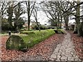
Air raid shelter, Kettlewell Lane, King's Lynn
This concrete shelter, built during World War 2 in a small recreation ground between the Gaywood River and the old city walls on Kettlewell Lane had space for 100 people according to www.heritage.norfolk.gov.uk/record-details?MNF31205-World-War-Two-air-raid-shelter-Kettlewell-Recreation-Ground&Index=28440&RecordCount=57339&SessionID=9e8d76ab-afdf-490b-b55a-8f28f36a1a43
Image: © Richard Humphrey
Taken: 5 Jan 2020
0.21 miles