
IMAGES TAKEN NEAR TO
St. Clements Passage, HUNTINGDON, PE29 3FH
Introduction
This page details the photographs taken nearby to St. Clements Passage, PE29 3FH by members of the Geograph project.
The Geograph project started in 2005 with the aim of publishing, organising and preserving representative images for every square kilometre of Great Britain, Ireland and the Isle of Man.

There are currently over 7.5m images from over14,400 individuals and you can help contribute to the project by visiting https://www.geograph.org.uk
Image Map
Images are licensed for reuse under creativecommons.org/licenses/by-sa/2.0
Notes
- Clicking on the map will re-center to the selected point.
- The higher the marker number, the further away the image location is from the centre of the postcode.
Image Listing (279 Images Found)
Images are licensed for reuse under creativecommons.org/licenses/by-sa/2.0
Image
Details
Distance
1

151 High Street, Huntingdon
Dates from the early nineteenth century https://historicengland.org.uk/listing/the-list/list-entry/1330686
Image: © Jonathan Thacker
Taken: 10 Aug 2021
0.03 miles
2

Huntingdon - Samuel Pepys
High Street pub in central Huntingdon. Pepys attended the local grammar school.
www.huntingdontown.gov.uk
Image: © Colin Smith
Taken: 9 Jun 2021
0.04 miles

4

High Street, Huntingdon
The river end of the High Street.
Image: © Jonathan Thacker
Taken: 10 Aug 2021
0.04 miles
5

152 High Street, Huntingdon
Late eighteenth century house now subdivided https://historicengland.org.uk/listing/the-list/list-entry/1309881?section=official-list-entry
Image: © Jonathan Thacker
Taken: 26 Aug 2021
0.04 miles
6

144 and 146 High Street, Huntingdon
Probably date from the very end of the nineteenth century and built in styles that were fashionable at the time. Not listed but deserve to be.
Image: © Jonathan Thacker
Taken: 26 Aug 2021
0.04 miles
7

Huntingdon High Street
The south-east end of the High Street, now mainly pubs and restaurants, seems to be thriving, while the north west end is full of estate agents and empty shops. The building of the ring road in the 1970s effectively severed the artery of the High Street from the wider Huntingdon and while the centre of the town is fairly busy the ring road leads shoppers round and round and on to large supermarkets.
Image: © Duncan Grey
Taken: 22 Sep 2008
0.05 miles

9

St. Mary's Church, Huntingdon. Floodlit Summer 2008
Before 1108 the Priory of St. Mary, Huntingdon and mentioned in Domesday Book.
Image: © richard meredith
Taken: 15 Jun 2008
0.05 miles
10
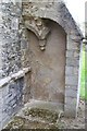
Remains of east end St. Mary's church
The East end as bashed around with. The alcove shows the only remaining evidence of the probable Lady Chapel which extended another 25 foot eastwards.
Image: © richard meredith
Taken: 3 Sep 2008
0.05 miles