
IMAGES TAKEN NEAR TO
Berry Lane, HUNTINGDON, PE29 2LA
Introduction
This page details the photographs taken nearby to Berry Lane, PE29 2LA by members of the Geograph project.
The Geograph project started in 2005 with the aim of publishing, organising and preserving representative images for every square kilometre of Great Britain, Ireland and the Isle of Man.

There are currently over 7.5m images from over14,400 individuals and you can help contribute to the project by visiting https://www.geograph.org.uk
Image Map
Images are licensed for reuse under creativecommons.org/licenses/by-sa/2.0
Notes
- Clicking on the map will re-center to the selected point.
- The higher the marker number, the further away the image location is from the centre of the postcode.
Image Listing (10 Images Found)
Images are licensed for reuse under creativecommons.org/licenses/by-sa/2.0
Image
Details
Distance
1

Crop field and mature hedgerow
Just north of Berry Lane.
Image: © JThomas
Taken: 4 Jun 2015
0.03 miles

3

The Great Ouse and The Alconbury Brook
These rivers border Port Holme, "the biggest meadow in the land."
Image: © Duncan Grey
Taken: 18 Sep 2008
0.09 miles


7

Tree upheaval
Recent strong winds have downed six or seven poplar trees on the side of the B1043. Shallow rooting, dry soil, and the fact that they appear to have grown out on a roadstone surface haven't helped.
Image: © Michael Trolove
Taken: 14 May 2017
0.18 miles
8
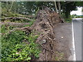
Tree upheaval
Poplar trees lying prone by the B1043.
Image: © Michael Trolove
Taken: 14 May 2017
0.18 miles

10

Pasture, West Farm, near Godmanchester
Image: © Simon Mortimer
Taken: 12 Jun 2007
0.24 miles