
IMAGES TAKEN NEAR TO
The Spinney, HUNTINGDON, PE29 1YP
Introduction
This page details the photographs taken nearby to The Spinney, PE29 1YP by members of the Geograph project.
The Geograph project started in 2005 with the aim of publishing, organising and preserving representative images for every square kilometre of Great Britain, Ireland and the Isle of Man.

There are currently over 7.5m images from over14,400 individuals and you can help contribute to the project by visiting https://www.geograph.org.uk
Image Map
Images are licensed for reuse under creativecommons.org/licenses/by-sa/2.0
Notes
- Clicking on the map will re-center to the selected point.
- The higher the marker number, the further away the image location is from the centre of the postcode.
Image Listing (51 Images Found)
Images are licensed for reuse under creativecommons.org/licenses/by-sa/2.0
Image
Details
Distance
1
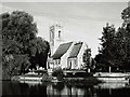
Hartford Church
Hartford Church from the south bank of the River Great Ouse. This image was taken during a photographic session for the Images of England project run by English Heritage.
Image: © John Webber
Taken: 3 Oct 2002
0.04 miles
4
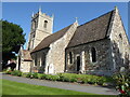
Huntingdon - Hartford Church
All Saints' was built in 1180 beside the River Great Ouse, on the site of a Roman watch tower. Much rebuilding was carried out in 1861 and 1895.
www.allsaintshartford.org.uk
Image: © Colin Smith
Taken: 9 Jun 2021
0.04 miles
5

Here comes a fire engine
Hurrying along Longstaff Way, Huntingdon.
Image: © Robin Webster
Taken: 17 Feb 2019
0.04 miles
6
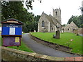
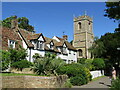
All Saints Church, Hartford, Huntingdon
Image: © Richard Humphrey
Taken: 1 Sep 2014
0.05 miles

8
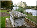
Tomb chest in All Saints churchyard, Hartford, Huntingdon
Sacred to the memory of Henry Thomas Barratt
Image: © Richard Humphrey
Taken: 30 Oct 2016
0.06 miles
9

Ordnance Survey Benchmark - Hartford, Barley Mow Inn
Ordnance Survey Benchmark (OSBM) used for levelling height above Ordnance Datum (OD).
Height (1966): 11.0399m OD (Newlyn). Mark verified by the Ordnance Survey in 1966. Description: PH NO 42 MAIN ST SW FACE S ANG. 0.2m above ground. 3rd Order BM.
The mark was used on the Thrapstone to Chelmsford line of the First Primary Levelling of England & Wales in 1851-1857. It was levelled with a height of 37.414' above OD (Liverpool). Description: 37. Mark on South-east corner of the Barley Mow Inn, Hartford ; 1.94 ft. above surface. Page 318 of the abstract: http://www.trigtools.co.uk/data/1GL/1GLA_318.png
Context: Image
Image: © N Scott
Taken: 8 Jan 2016
0.06 miles
10

Ordnance Survey Benchmark - Hartford, Barley Mow Inn
Ordnance Survey Benchmark (OSBM) used for levelling height above Ordnance Datum (OD).
Height (1966): 11.0399m OD (Newlyn). Mark verified by the Ordnance Survey in 1966. Description: PH NO 42 MAIN ST SW FACE S ANG. 0.2m above ground. 3rd Order BM.
The mark was used on the Thrapstone to Chelmsford line of the First Primary Levelling of England & Wales in 1851-1857. It was levelled with a height of 37.414' above OD (Liverpool). Description: 37. Mark on South-east corner of the Barley Mow Inn, Hartford ; 1.94 ft. above surface. Page 318 of the abstract: http://www.trigtools.co.uk/data/1GL/1GLA_318.png
Close-up: Image
Image: © N Scott
Taken: 8 Jan 2016
0.06 miles