
IMAGES TAKEN NEAR TO
Mill Close, HUNTINGDON, PE28 9DJ
Introduction
This page details the photographs taken nearby to Mill Close, PE28 9DJ by members of the Geograph project.
The Geograph project started in 2005 with the aim of publishing, organising and preserving representative images for every square kilometre of Great Britain, Ireland and the Isle of Man.

There are currently over 7.5m images from over14,400 individuals and you can help contribute to the project by visiting https://www.geograph.org.uk
Image Map
Images are licensed for reuse under creativecommons.org/licenses/by-sa/2.0
Notes
- Clicking on the map will re-center to the selected point.
- The higher the marker number, the further away the image location is from the centre of the postcode.
Image Listing (65 Images Found)
Images are licensed for reuse under creativecommons.org/licenses/by-sa/2.0
Image
Details
Distance
1

Hemingford Grey: Meadow Lane
At the north end of the village, leading to the water meadows by the Great Ouse and the footpath to St Ives.
Image: © John Sutton
Taken: 30 Sep 2016
0.07 miles
2
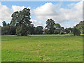
Hemingford Grey: a view from Mill Lane
A view over the hedge, with Hemingford Grey House and the tower of St James's Church showing between the trees in the centre.
Image: © John Sutton
Taken: 30 Sep 2016
0.10 miles
3

Hemingford Grey House
A 350 year old red brick house on the bank of the river Ouse. The house is used as a conference centre for both day conferences and residential courses. St James church is right behind the house. Apparently, Cromwell a local boy, got his Roundhead army to destroy the original house that stood on this site.
Image: © Michael Trolove
Taken: 13 Jan 2010
0.13 miles

5

Close up of mass dial on buttress of St. James church
This close-up of the mass dial shows how the hole that held the gnomon (or pointer) has been filled.
Image: © Mark Hurn
Taken: 25 Sep 2009
0.16 miles
6

Hemingford Grey: Church Street
The sun was momentarily behind high cloud on the fine morning of the last day of September.
Image: © John Sutton
Taken: 30 Sep 2016
0.16 miles
7

Buttress on S.E. corner of St. James church
This buttress on the S.E. corner of St. James church, shows the location of the remains of a mass dial.
Image: © Mark Hurn
Taken: 25 Sep 2009
0.16 miles
8

St. James church, Hemingford Grey
Photographed on a dull January day, St.James church features a much smaller spire on the bell tower as the original blew down in a gale in the 1700's.
Image: © Michael Trolove
Taken: 13 Jan 2010
0.17 miles
9
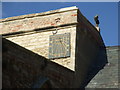
Sundial on St. James church
A modern (2004) sundial continues an ancient tradition of time-keeping on churches. St. James church also has the remains of a mass-dial on a buttress on the S.E. corner.
Image: © Mark Hurn
Taken: 25 Sep 2009
0.17 miles
10

St James Church, Hemingford Grey
Construction was started c1160 by Payn of Hemingford. The top of the spire was blown into the river by a storm in 1741 but was not rebuilt.
Image: © Rob Noble
Taken: 12 Feb 2011
0.17 miles