
IMAGES TAKEN NEAR TO
Woodwalton, HUNTINGDON, PE28 5YL
Introduction
This page details the photographs taken nearby to PE28 5YL by members of the Geograph project.
The Geograph project started in 2005 with the aim of publishing, organising and preserving representative images for every square kilometre of Great Britain, Ireland and the Isle of Man.

There are currently over 7.5m images from over14,400 individuals and you can help contribute to the project by visiting https://www.geograph.org.uk
Image Map
Images are licensed for reuse under creativecommons.org/licenses/by-sa/2.0
Notes
- Clicking on the map will re-center to the selected point.
- The higher the marker number, the further away the image location is from the centre of the postcode.
Image Listing (12 Images Found)
Images are licensed for reuse under creativecommons.org/licenses/by-sa/2.0
Image
Details
Distance
2

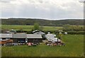
Red House Farm
Seen from the Railway.
Image: © Julian P Guffogg
Taken: 5 May 2012
0.08 miles
4
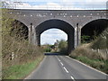
Railway bridge
Wood Walton village is just the other side of the bridge.
Image: © Michael Trolove
Taken: 5 Apr 2009
0.18 miles
5

Ordnance Survey Flush Bracket S9285
This can be found on the railway bridge wall at Wood Walton.
For more detail see : http://www.bench-marks.org.uk/bm12944
Image: © Peter Wood
Taken: 20 Jul 2014
0.20 miles
6
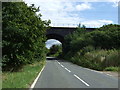
Railway bridge over Bridge Street Wood Walton
Looking east.
Image: © JThomas
Taken: 16 Aug 2014
0.20 miles
7

Railway bridge over Bridge Street Wood Walton
Looking west.
Image: © JThomas
Taken: 16 Aug 2014
0.20 miles
8

Flush Bracket Bench Mark, Wood Walton
Fixed to the rail bridge at Wood Walton.
Image: © Michael Trolove
Taken: 5 Apr 2009
0.20 miles
9
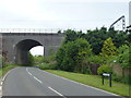
Railway arch in Wood Walton
The east coast main line railway dominates this small village
Image: © Richard Humphrey
Taken: 22 May 2013
0.20 miles
10

View from a Peterborough-London train - Wood Walton
Image: © Nigel Thompson
Taken: 2 Mar 2017
0.23 miles