
IMAGES TAKEN NEAR TO
Hamerton, HUNTINGDON, PE28 5QU
Introduction
This page details the photographs taken nearby to PE28 5QU by members of the Geograph project.
The Geograph project started in 2005 with the aim of publishing, organising and preserving representative images for every square kilometre of Great Britain, Ireland and the Isle of Man.

There are currently over 7.5m images from over14,400 individuals and you can help contribute to the project by visiting https://www.geograph.org.uk
Image Map
Images are licensed for reuse under creativecommons.org/licenses/by-sa/2.0
Notes
- Clicking on the map will re-center to the selected point.
- The higher the marker number, the further away the image location is from the centre of the postcode.
Image Listing (35 Images Found)
Images are licensed for reuse under creativecommons.org/licenses/by-sa/2.0
Image
Details
Distance

2
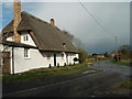
Thatched Cottage, Hamerton
The road ahead goes to Alconbury Weston and is also part of National Cycle Network route 12.
Image: © Michael Trolove
Taken: 5 Apr 2008
0.04 miles
3

Minor road junction with a grass centre
A classic grass triangle in the middle of a road junction.
Image: © Michael Trolove
Taken: 1 Jan 2012
0.05 miles
4
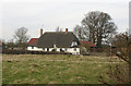
Thatched cottage, Hamerton
This cottage stands at the junction of Main Street and Gidding Road.
Image: © David Kemp
Taken: 12 Mar 2015
0.05 miles
6

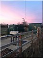
Hamerton floods
A road prone to quick flooding by the Alconbury Brook.
Heavy rain, about 25mm in the surrounding area on already saturated farmland brought out the Alconbury Brook to flood state within 4-5 hours. Historically an area prone to flooding and features here http://www.environment-agency.gov.uk/homeandleisure/floods/34681.aspx?area=052FWFAB1EL&page=1&type=Region&term=Anglian quite regularly.
Image: © Michael Trolove
Taken: 22 Nov 2012
0.09 miles
7
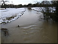
Cold and silt laden water flowing down the Alconbury Brook
This water will eventually end up in the river Ouse just beyond Brampton.
Image: © Michael Trolove
Taken: 10 Feb 2009
0.09 miles
8

Moderate flooding, Hamerton
Winter flood map from the Environment Agency.
http://maps.environment-agency.gov.uk/wiyby/mapFromCMSCodes?topic=fwa&layerGroup=1&lang=_e&codes=AB1EL
Image: © Michael Trolove
Taken: 10 Feb 2009
0.09 miles
9
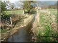
The Alconbury Brook
Looking fairly sedate from this view, the Alconbury brook can quickly flood around this location. The steps on the left lead up to an Environment Agency monitoring station.
Image: © Michael Trolove
Taken: 5 Apr 2008
0.10 miles
10

Church Bridge, Hamerton
A Grade II listed medieval bridge (with 20th century rebuilding) crossing Alconbury Brook, and connecting the church to the village.
Image: © Tim Heaton
Taken: 23 Apr 2021
0.10 miles