
IMAGES TAKEN NEAR TO
Saxon Close, HUNTINGDON, PE28 5NE
Introduction
This page details the photographs taken nearby to Saxon Close, PE28 5NE by members of the Geograph project.
The Geograph project started in 2005 with the aim of publishing, organising and preserving representative images for every square kilometre of Great Britain, Ireland and the Isle of Man.

There are currently over 7.5m images from over14,400 individuals and you can help contribute to the project by visiting https://www.geograph.org.uk
Image Map
Images are licensed for reuse under creativecommons.org/licenses/by-sa/2.0
Notes
- Clicking on the map will re-center to the selected point.
- The higher the marker number, the further away the image location is from the centre of the postcode.
Image Listing (20 Images Found)
Images are licensed for reuse under creativecommons.org/licenses/by-sa/2.0
Image
Details
Distance
1

Spray on the A1(M)
Following a heavy shower.
Image: © JThomas
Taken: 15 Jun 2012
0.15 miles
2

Old Boundary Marker by the B1043, Old Great North Road
Parish Boundary Marker by the B1043, in parish of Sawtry (Huntingdonshire District), Old Great North Road, on verge against fence, West side of road.
Inscription reads:-
: SAWTRY / ST / JUDITH : : PARISH / BOUNDARY : : SAWTRY / ST / ANDREW :
Grade II Listed. List Entry Number: 1109681
https://historicengland.org.uk/listing/the-list/list-entry/1109681
Surveyed
Milestone Society National ID: HU_SAW03pb
Image: © M Bardell
Taken: Unknown
0.15 miles
3

Old Boundary Marker by the B1043, Old Great North Road, Sawtry parish
Parish Boundary Marker by the B1043 (was A1), in parish of Sawtry (Huntingdonshire District), Old Great North Road, South of Stanch-hill Bridge.
Inscription reads:-
: SAWTRY / ST / JUDITH : : PARISH / BOUNDARY : : SAWTRY / ST / ANDREW :
Grade II listed.
List Entry Number: 1109681 https://historicengland.org.uk/listing/the-list/list-entry/1109681
To be surveyed
Milestone Society National ID: HU_SAW03pb
Image: © Milestone Society
Taken: Unknown
0.15 miles

5

Parish Boundary Sawtry
Installed when the A1 was upgraded to motorway status.
Image: © Michael Trolove
Taken: 12 Nov 2008
0.17 miles


8
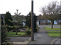
Chesham road, Sawtry
Another residential road in Sawtry, another Monkey Puzzle tree. Image
Image: © Michael Trolove
Taken: 12 Nov 2009
0.17 miles

10
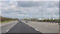
A1(M) junction 15 near Sawtry
The town is on the left.
Image: © Julian P Guffogg
Taken: 4 May 2013
0.18 miles