
IMAGES TAKEN NEAR TO
The Avenue, HUNTINGDON, PE28 5AW
Introduction
This page details the photographs taken nearby to The Avenue, PE28 5AW by members of the Geograph project.
The Geograph project started in 2005 with the aim of publishing, organising and preserving representative images for every square kilometre of Great Britain, Ireland and the Isle of Man.

There are currently over 7.5m images from over14,400 individuals and you can help contribute to the project by visiting https://www.geograph.org.uk
Image Map
Images are licensed for reuse under creativecommons.org/licenses/by-sa/2.0
Notes
- Clicking on the map will re-center to the selected point.
- The higher the marker number, the further away the image location is from the centre of the postcode.
Image Listing (65 Images Found)
Images are licensed for reuse under creativecommons.org/licenses/by-sa/2.0
Image
Details
Distance
1
Leighton Bromswold
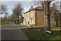
Looking along The Avenue. Leighton Bromswold is built astride a prominent ridge and consists of a wide main street (The Avenue) running north-west from the church along the line of the ridge. The village is designated a conservation area. The hand-written notice on the right is advertising 'traditional farm cockerels - oven ready'.
Image: © Stephen McKay
Taken: 2 Feb 2008
0.01 miles
2
The Green Man, Leighton Bromswold
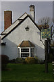
Grade II listed village pub - this is the side view at the top of Staunch Hill.
Image: © Stephen McKay
Taken: 2 Feb 2008
0.02 miles

4
Leighton Bromswold: The Green Man
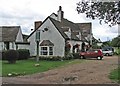
Bright hanging baskets on an overcast September morning.
Image: © John Sutton
Taken: 3 Sep 2015
0.02 miles
5

Village Notice Board, Leighton Bromswold
This well-stocked notice case is on the north side of The Avenue. There is clearly pride in achieving the Cambridgeshire Small Village of the year award in 1999, although prior to the 1974 local government reorganisation this was Huntingdonshire.
Image: © Stephen McKay
Taken: 2 Feb 2008
0.02 miles
6
Leighton Bromswold
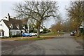
A remote place surrounded by miles of unpopulated farmland. The building on the left is shown on the OS map as a public house but seems now to be closed.
Image: © David Kemp
Taken: 10 Nov 2011
0.03 miles
7

Leighton Bromswold: aerial 2025 (2)
Earthworks in foreground, see https://www.heritagegateway.org.uk/Gateway/Results_Single.aspx?uid=MCB918&resourceID=1000.
Gate House above left - see https://www.heritagegateway.org.uk/Gateway/Results_Single.aspx?uid=MCB920&resourceID=1000.
Soil marks above centre in Image
Image: © Chris
Taken: 6 Sep 2025
0.04 miles
8
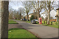
Leighton Bromswold
Showing the western end of the village, which has a population of around 200. It is mentioned in the Domesday Book and was once a more important place than it is now, having a market charter in the middle ages.
Image: © Stephen McKay
Taken: 2 Feb 2008
0.05 miles
9

Leighton Bromswold
Looking south-east towards the church along The Avenue.
Image: © David Kemp
Taken: 10 Nov 2011
0.06 miles
10

Leighton Bromswold: aerial 2025 (1)
Gate House right, in trees - see https://www.heritagegateway.org.uk/Gateway/Results_Single.aspx?uid=MCB920&resourceID=1000.
Image: © Chris
Taken: 6 Sep 2025
0.11 miles