
IMAGES TAKEN NEAR TO
The Boulevard, Enterprise Campus, HUNTINGDON, PE28 4XA
Introduction
This page details the photographs taken nearby to The Boulevard, Enterprise Campus, PE28 4XA by members of the Geograph project.
The Geograph project started in 2005 with the aim of publishing, organising and preserving representative images for every square kilometre of Great Britain, Ireland and the Isle of Man.

There are currently over 7.5m images from over14,400 individuals and you can help contribute to the project by visiting https://www.geograph.org.uk
Image Map
Images are licensed for reuse under creativecommons.org/licenses/by-sa/2.0
Notes
- Clicking on the map will re-center to the selected point.
- The higher the marker number, the further away the image location is from the centre of the postcode.
Image Listing (22 Images Found)
Images are licensed for reuse under creativecommons.org/licenses/by-sa/2.0
Image
Details
Distance
1

Gymnasium and cafe building
New building on Alconbury Weald formerly USAF Alconbury. Location is approximate as re-alignment of the roads and general construction work and map data all need to catch up.
http://www.alconbury-weald.co.uk/
Image: © Michael Trolove
Taken: 30 Sep 2017
0.04 miles
2

Beyond The Perimeter Fence Alconbury Airfield
Had stick the camera through the mesh fence for a general view of the airfield space.
Image: © Michael Trolove
Taken: 26 Dec 2008
0.08 miles

4

Original WWII structure
Former control tower on the Alconbury Airfield now known as Alconbury Weald.
Location is approximate as development work has obliterated original reference points.
The structure is likely to be preserved as a link to the former activity in this area.
Image: © Michael Trolove
Taken: 30 Sep 2017
0.10 miles
5

New Shire Hall, Alconbury Weald
Cambridgeshire County Council used to be based in Cambridge but they decided to move here in 2018, despite the poor public transport links.
Image: © Hugh Venables
Taken: 27 Oct 2024
0.10 miles
6

RAF Alconbury
Old buildings on part of the redeveloped RAF Alconbury site.
Image: © Peter McDermott
Taken: 25 Jul 2018
0.10 miles
7
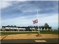
Green Space near Cambridgeshire Council Offices
Image: © Anthony Parkes
Taken: 14 Sep 2022
0.10 miles
8

Gate House to Alconbury Airfield
The former RAF/ USAF air base is transforming into a freight handling depot or an extension to Felixstowe docks with the A14 being the internal road. (Depending on your point of view) Plans have been mooted to bring a connection from the east coast main line for a rail freight hub. Other areas of the field are given over to vehicle storage and many small businesses operate from this site.
Image: © Michael Trolove
Taken: 26 Dec 2008
0.10 miles
9

RAF Alconbury Memorial
RAF Alconbury memorial dedication to 19 airmen of the 95th bomb group who lost their lives when a 500lb bomb exploded accidentally.
Image: © Chris Lowe
Taken: 27 May 2013
0.11 miles
10

New Shire Hall, Alconbury Weald
The headquarters of Cambridgeshire County Council.
Image: © Jonathan Thacker
Taken: 10 Aug 2021
0.11 miles