
IMAGES TAKEN NEAR TO
Orchard Lane, HUNTINGDON, PE28 4TF
Introduction
This page details the photographs taken nearby to Orchard Lane, PE28 4TF by members of the Geograph project.
The Geograph project started in 2005 with the aim of publishing, organising and preserving representative images for every square kilometre of Great Britain, Ireland and the Isle of Man.

There are currently over 7.5m images from over14,400 individuals and you can help contribute to the project by visiting https://www.geograph.org.uk
Image Map
Images are licensed for reuse under creativecommons.org/licenses/by-sa/2.0
Notes
- Clicking on the map will re-center to the selected point.
- The higher the marker number, the further away the image location is from the centre of the postcode.
Image Listing (18 Images Found)
Images are licensed for reuse under creativecommons.org/licenses/by-sa/2.0
Image
Details
Distance
1

Thrapston Road
Thrapston Road passing the Brampton Memorial Hall
Image: © Shaun Ferguson
Taken: 19 Mar 2009
0.06 miles
2

High Street, Brampton
Looking along High Street with a very light dusting of snow on the ground.
Image: © Stephen McKay
Taken: 19 Dec 2010
0.09 miles
4

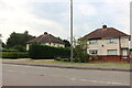
Horseshoes Way, Brampton
The western end of Horseshoes Way seen from its junction with High Street.
Image: © Stephen McKay
Taken: 19 Dec 2010
0.11 miles
5
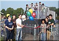
Official Opening of Brampton Skate Park
After much fundraising and campaigning Brampton finally got a skate park in 2005. The driving force was the Broken Circle Project which was a group of young people taking on the goal of improving community relations and youth facilities in Brampton. The team were finalists in the Prince’s Trust Community Project Awards 2004-05.
Image: © Tim Fryer
Taken: 15 Oct 2005
0.11 miles
6

Old Direction Sign - Signpost by High Street, Brampton parish
Annulus finial - 2 arms; Hunts. halo by the UC road, in parish of Brampton (Huntingdonshire District), opposite junction of Grove Lane with High Street, on footway.
Surveyed
Milestone Society National ID: HU_TL2071
Image: © Milestone Society
Taken: Unknown
0.11 miles
7

Old Milestone by the B1514, Thrapston Road, Brampton
Carved stone post by the B1514, in parish of BRAMPTON (HUNTINGDONSHIRE District), Thrapston Road, by No. 102, opposite Grove Lane, on the verge, on North side of road. Huntingdon stone, erected by the Market Harborough & Brampton turnpike trust in the 19th century.
Inscription reads:-
: TO / HUNTINGDON / 2 / MILES : : TO / THRAPSTON / 15 / MILES :
Carved benchmark on back.
Cambridgeshire HER.
CHER Number: MCB18027 https://www.heritagegateway.org.uk/Gateway/Results_Single.aspx?uid=MCB18027&resourceID=1000
Milestone Society National ID: HU_HUTH02.
Image: © MW Hallett
Taken: 29 Jul 2006
0.11 miles

9

Old Milepost
Old milepost at Brampton, Cambridgeshire for overall view see http://www.geograph.org.uk/photo/2880375
Image: © Keith Evans
Taken: 2 Apr 2012
0.12 miles
10

To Thrapston 15
Old milepost at Brampton, Cambridgeshire for close up view see http://www.geograph.org.uk/photo/2880369
Image: © Keith Evans
Taken: 2 Apr 2012
0.13 miles