
IMAGES TAKEN NEAR TO
Eppeworth Drive, HUNTINGDON, PE28 4NA
Introduction
This page details the photographs taken nearby to Eppeworth Drive, PE28 4NA by members of the Geograph project.
The Geograph project started in 2005 with the aim of publishing, organising and preserving representative images for every square kilometre of Great Britain, Ireland and the Isle of Man.

There are currently over 7.5m images from over14,400 individuals and you can help contribute to the project by visiting https://www.geograph.org.uk
Image Map
Images are licensed for reuse under creativecommons.org/licenses/by-sa/2.0
Notes
- Clicking on the map will re-center to the selected point.
- The higher the marker number, the further away the image location is from the centre of the postcode.
Image Listing (18 Images Found)
Images are licensed for reuse under creativecommons.org/licenses/by-sa/2.0
Image
Details
Distance
1

RAF Alconbury
Former airfield site. Now (as a result of its key location close to the A1, A14 & M11) largely used as a distribution centre.
Image: © Tim Heaton
Taken: 8 Jul 2007
0.16 miles
2

Attenuation pond, Alconbury Weald
One of many small ponds or damp areas scattered around the new development.
Image: © Hugh Venables
Taken: 27 Oct 2024
0.18 miles
3

Old Broken Milestone
Old broken milestone near to Alconbury, Cambridgeshire. Sadly this is the lower part as a new ditch has been dug I assume this was found then as I had looked for this stone last year without any luck. For overall view see http://www.geograph.org.uk/photo/1780638
Image: © Keith Evans
Taken: 1 Apr 2010
0.19 miles
4

Old Broken Milestone
Old broken milestone near to Alconbury, Cambridgeshire. Sadly this is the lower part as a new ditch has been dug I assume this was found then as I had looked for this stone last year without any luck. For close up view see http://www.geograph.org.uk/photo/1780634
Image: © Keith Evans
Taken: 1 Apr 2010
0.19 miles
5
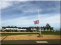
Green Space near Cambridgeshire Council Offices
Image: © Anthony Parkes
Taken: 14 Sep 2022
0.20 miles
6

The perimeter of Alconbury airfield
Limited opportunities for photography in this square unless you have business on the former USAF airfield.
Image: © Michael Trolove
Taken: 18 Jul 2009
0.20 miles
7

Beyond The Perimeter Fence Alconbury Airfield
Had stick the camera through the mesh fence for a general view of the airfield space.
Image: © Michael Trolove
Taken: 26 Dec 2008
0.21 miles
8

Path alongside the Alconbury Weald development
The path runs along a raised bank - presumably designed to minimise noise from the nearby road.
Image: © Tim Heaton
Taken: 23 Apr 2021
0.21 miles
9

Ermine Street
Ermine Street heading to A14(M) junction
Image: © Shaun Ferguson
Taken: 12 Feb 2013
0.21 miles
10

Co-op store, Alconbury Weald
Recent addition to the new town.
Image: © Hugh Venables
Taken: 27 Oct 2024
0.22 miles