
IMAGES TAKEN NEAR TO
Ash End, HUNTINGDON, PE28 4EY
Introduction
This page details the photographs taken nearby to Ash End, PE28 4EY by members of the Geograph project.
The Geograph project started in 2005 with the aim of publishing, organising and preserving representative images for every square kilometre of Great Britain, Ireland and the Isle of Man.

There are currently over 7.5m images from over14,400 individuals and you can help contribute to the project by visiting https://www.geograph.org.uk
Image Map
Images are licensed for reuse under creativecommons.org/licenses/by-sa/2.0
Notes
- Clicking on the map will re-center to the selected point.
- The higher the marker number, the further away the image location is from the centre of the postcode.
Image Listing (18 Images Found)
Images are licensed for reuse under creativecommons.org/licenses/by-sa/2.0
Image
Details
Distance

2

On Cycle Route 12, about to pass under the A1(M)
Alconbury is on the other side.
Image: © Tim Heaton
Taken: 23 Apr 2021
0.11 miles
3
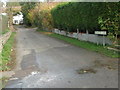
Frumetty Lane Alconbury
Nothing found to reveal who or what a frumetty is.
Image: © Michael Trolove
Taken: 12 Nov 2008
0.17 miles
4

A1 Passing Alconbury
The A1 is the elevated section, the bridge span allows access to Alconbury village. A road off the roundabout to the left allows access to the southbound A1 and the road towards the camera leads to the A14 and Huntingdon.
Image: © Michael Trolove
Taken: 26 Dec 2008
0.17 miles
5
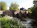
The Bridge, Alconbury
Straddling the Alconbury Brook and dating from 15th century; frequently requiring patching up as it is still a vital link between one side of the village and the other.
Image: © Philip Pankhurst
Taken: 22 May 2010
0.19 miles
6

Chapel Street, Alconbury
On the left is the 16th century Manor House Hotel, seen during a brief respite from the rain on a very dull day.
Image: © Stephen McKay
Taken: 13 Dec 2008
0.19 miles
7

Festive Joy
Christmas tree in the centre of Alconbury
Image: © Morris Doris
Taken: 13 Dec 2010
0.20 miles
8
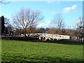
Footbridge at Alconbury
Adjacent to the C15 roadbridge. Unfortunately the sun was too low to take a shot of the more interesting bridge on the other side-so see http://www.geograph.org.uk/photo/1875664
Image: © Bikeboy
Taken: 16 Feb 2014
0.20 miles
9

Alconbury Brook
Alconbury Brook flowing under Mill Road bridge
Image: © Shaun Ferguson
Taken: 12 Feb 2013
0.21 miles
10
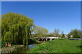
The Green next to Alconbury Brook, Alconbury
In the distance a listed Grade II, 15th century bridge https://historicengland.org.uk/listing/the-list/list-entry/1317661, with a later footbridge on this side (white fencing).
Image: © Tim Heaton
Taken: 23 Apr 2021
0.21 miles