
IMAGES TAKEN NEAR TO
Church Walk, HUNTINGDON, PE28 2AH
Introduction
This page details the photographs taken nearby to Church Walk, PE28 2AH by members of the Geograph project.
The Geograph project started in 2005 with the aim of publishing, organising and preserving representative images for every square kilometre of Great Britain, Ireland and the Isle of Man.

There are currently over 7.5m images from over14,400 individuals and you can help contribute to the project by visiting https://www.geograph.org.uk
Image Map
Images are licensed for reuse under creativecommons.org/licenses/by-sa/2.0
Notes
- Clicking on the map will re-center to the selected point.
- The higher the marker number, the further away the image location is from the centre of the postcode.
Image Listing (113 Images Found)
Images are licensed for reuse under creativecommons.org/licenses/by-sa/2.0
Image
Details
Distance
1

Footpath towards Huntingdon Road
The footpath from Rectory Lane to Huntingdon Road.
Image: © David P Howard
Taken: 18 Sep 2013
0.01 miles
2

Stuart Cottage, Church Walk, Houghton and Wyton
Grade II Listed 17th century timber-framed cottage. Alterations and extensions were approved in 1981.
Image: © Jo and Steve Turner
Taken: 31 Aug 2023
0.02 miles
3

Stuart House, Huntingdon Road, Houghton and Wyton
Grade II Listed timber-framed farmhouse and barn with a 1648 date plaque. With identical construction as The Three Jolly Butchers, both properties could be by the same builder. On the far left is an 18th century rendered, red brick extension at a slightly higher floor level than the original house. At the back is a brick kitchen dating from around 1800. There is a working well in the garden, situated for easy access to the original kitchen. The roof was rebuilt in 2011 reusing existing tiles where possible.
Image: © Jo and Steve Turner
Taken: 31 Aug 2023
0.03 miles
4

St Margaret and All Saints Churchyard, Rectory Lane, Houghton and Wyton
The church was declared redundant in 1974 and is now in private hands. The churchyard contains the graves of two casualties from the 1914-18 war and 24 from the 1939-45 war, all of whom served with the air forces of the Commonwealth. Most are buried in a plot set aside for casualties from the nearby airfield at Wyton during the Second World War.
Image: © Jo and Steve Turner
Taken: 31 Aug 2023
0.04 miles
5

Burial ground in Houghton & Wyton
There are a number of Commonwealth war graves in this burial ground
Image: © Richard Humphrey
Taken: 30 Aug 2020
0.04 miles
6

The Schae, Church Walk, Houghton and Wyton
Timber-framed Grade II Listed 17th century cottage. Two-storey bay to left hand gable end is about 1900 and porch is modern. In 1998 planning approved 'extension & alterations to dwelling'. The poorly constructed 1960's single-storey kitchen extension on the south gable was to be rebuilt in 2015 much larger and incorporating the rear garden wall. This plan was never implemented and a smaller, more in keeping, replacement was approved this year (2023).
Image: © Jo and Steve Turner
Taken: 31 Aug 2023
0.04 miles
7

Magdalene House, Huntingdon Road, Houghton and Wyton
Early 17th century Grade II Listed timber-framed former farmhouse listed as Magdalene House and Dove Cote. The current OS map shows the building split with Dove Cote as the right (west) section with reduced roof hight. Obviously split at some stage (as listed in 1982), it is now a single dwelling. It was originally part of Magdalene College Farm. Many of the farm buildings have been pulled down over the years and in 1986 Magdalene House underwent major renovation work. In 1982 planning approved extension to the kitchen (just in view). The adjacent Loxley Barn seems to have been converted to an annex in 1989 followed by conversion to studio/office in 1995. Extension to dwelling was also included in the same approval. In 2005/2006 the annex was further converted for B&B accommodation that now appears to be no longer available.
Image: © Jo and Steve Turner
Taken: 31 Aug 2023
0.04 miles
8
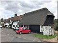
Thatched buildings in Houghton and Wyton
On Huntingdon Road - once the main route to Huntingdon before the villages were bypassed.
Image: © Richard Humphrey
Taken: 30 Aug 2020
0.05 miles
9

Wyton (St Margarets and All Saints) Churchyard
The churchyard contains the graves of two casualties from the 1914-18 war and 24 from the 1939-45 war, all of whom served with the air forces of the Commonwealth. Most are buried in a plot set aside for casualties from the nearby airfield at Wyton during the Second World War. http://www.cwgc.org/find-a-cemetery/cemetery/2077710/Wyton%20%28St.%20Margaret%20and%20All%20Saints%29%20Churchyard
The church in the background was All Saints, a Grade 1 listed building. http://www.britishlistedbuildings.co.uk/en-54072-church-of-all-saints-houghton-and-wyton-c
It is now a private house so I didn't photograph it in detail.
Image: © David P Howard
Taken: 18 Sep 2013
0.05 miles
10

Thatched cottage on Rectory Lane, Houghton and Wyton
Image: © Richard Humphrey
Taken: 30 Aug 2020
0.05 miles