
IMAGES TAKEN NEAR TO
High Street, HUNTINGDON, PE28 0TD
Introduction
This page details the photographs taken nearby to High Street, PE28 0TD by members of the Geograph project.
The Geograph project started in 2005 with the aim of publishing, organising and preserving representative images for every square kilometre of Great Britain, Ireland and the Isle of Man.

There are currently over 7.5m images from over14,400 individuals and you can help contribute to the project by visiting https://www.geograph.org.uk
Image Map
Images are licensed for reuse under creativecommons.org/licenses/by-sa/2.0
Notes
- Clicking on the map will re-center to the selected point.
- The higher the marker number, the further away the image location is from the centre of the postcode.
Image Listing (51 Images Found)
Images are licensed for reuse under creativecommons.org/licenses/by-sa/2.0
Image
Details
Distance
1
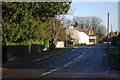
High Street, Spaldwick
This was once part of the A604; the village is now by-passed by what is now the A14 and little traffic uses High Street. The incessant roar of the nearby A14 could clearly be heard, however.
Image: © Stephen McKay
Taken: 6 Dec 2008
0.01 miles
2

Approaching Spaldwick from the east
The nearer sign advertises the Spaldwick 'Scarecrow Week', and the second the village fete on July 7. Clearly a village with an active spirit!
Image: © David Purchase
Taken: 1 Jul 2012
0.04 miles
3
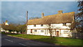
Cottages in Spaldwick, near Huntingdon
The metal fencing in front of the cottages suggests they are undergoing building work.
Image: © Malc McDonald
Taken: 7 Dec 2013
0.06 miles


6
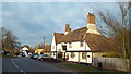
The George, Spaldwick
The George pub in the village of Spaldwick. The pub dates from 1679.
Image: © Malc McDonald
Taken: 7 Dec 2013
0.09 miles
7

Tree Guards beyond the call of duty
It will be interesting to see how much more of these metal tree guards will be consumed by the tree.
Image: © Michael Trolove
Taken: 4 Mar 2009
0.11 miles
8
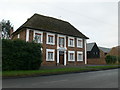
17th century house, Spaldwick
A red brick house with the initials P D and the date 1688 over the front door. This house was occupied by one William Ladds early in the 19th century and later by the Ashton family.
Image: © Eirian Evans
Taken: 18 Dec 2007
0.11 miles
9

Farmhouse, Spaldwick
17th century timber-framed farmhouse in the village of Spaldwick, between Huntingdon and Thrapston.
Image: © Eirian Evans
Taken: 18 Dec 2007
0.11 miles
10
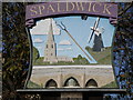
Village sign Spaldwick
This painted village sign includes a view of the church. The neighbouring villages seemed to compete to build the best spire in the 13th and 14th centuries.
Image: © Richard Greenwood
Taken: 7 Nov 2005
0.11 miles