
IMAGES TAKEN NEAR TO
Perry, HUNTINGDON, PE28 0BN
Introduction
This page details the photographs taken nearby to PE28 0BN by members of the Geograph project.
The Geograph project started in 2005 with the aim of publishing, organising and preserving representative images for every square kilometre of Great Britain, Ireland and the Isle of Man.

There are currently over 7.5m images from over14,400 individuals and you can help contribute to the project by visiting https://www.geograph.org.uk
Image Map
Images are licensed for reuse under creativecommons.org/licenses/by-sa/2.0
Notes
- Clicking on the map will re-center to the selected point.
- The higher the marker number, the further away the image location is from the centre of the postcode.
Image Listing (21 Images Found)
Images are licensed for reuse under creativecommons.org/licenses/by-sa/2.0
Image
Details
Distance
1
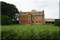
Highfield Farm
This solid farmhouse is probably a lot older than it seems. The brickwork appears to have been re-pointed recently, and the roof looks new. But the two-storey porch gives the game away. It is a listed building - according to the Huntingdonshire website, it is 'late 17th century'.
Image: © Bob Jones
Taken: 20 Aug 2007
0.05 miles
2
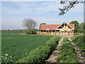
Timber lodges at Highfield Farm
Following the National Cycle Network routes 12 and 51 which follow the farm track and not the green dots as shown on the map. The signage is clear about this detour.
Image: © Michael Trolove
Taken: 24 Apr 2009
0.05 miles
3
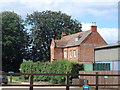
Highfield Farmhouse
Built in C17. See http://www.britishlistedbuildings.co.uk/en-54404-highfield-farmhouse-southoe-and-midloe-ca#.VdTyO_lViko for entry in British Listed Buildings.
Image: © Bikeboy
Taken: 15 Aug 2015
0.08 miles
4

Three Shires Way (foot and cycle path) south of Highfield Farm
Image: © David Smith
Taken: 11 Sep 2023
0.09 miles

6

NCN route 12 and 51
National Cycle Network routes 12 and 51 follow farm tracks to create a route to St Neots from Grafham Water and the reverse journey.
Image: © Michael Trolove
Taken: 24 Apr 2009
0.14 miles
7

Track (cycle route) passing Highfield Farm
Image: © David Smith
Taken: 11 Sep 2023
0.16 miles
8
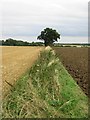
Field boundary near Highfield Farm
Looking eastwards from Three Shires Way.
Image: © Alison Rawson
Taken: 20 Aug 2007
0.17 miles
9

Cycleway and footpath at Plummer Park, Grafham Water
Image: © Mat Fascione
Taken: 5 Jun 2016
0.17 miles
