
IMAGES TAKEN NEAR TO
Needingworth Road, ST. IVES, PE27 5WN
Introduction
This page details the photographs taken nearby to Needingworth Road, PE27 5WN by members of the Geograph project.
The Geograph project started in 2005 with the aim of publishing, organising and preserving representative images for every square kilometre of Great Britain, Ireland and the Isle of Man.

There are currently over 7.5m images from over14,400 individuals and you can help contribute to the project by visiting https://www.geograph.org.uk
Image Map
Images are licensed for reuse under creativecommons.org/licenses/by-sa/2.0
Notes
- Clicking on the map will re-center to the selected point.
- The higher the marker number, the further away the image location is from the centre of the postcode.
Image Listing (52 Images Found)
Images are licensed for reuse under creativecommons.org/licenses/by-sa/2.0
Image
Details
Distance
1
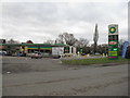
Services on the A1123 at St Ives
Fuel for cars and drivers.
Image: © M J Richardson
Taken: 9 Feb 2018
0.01 miles
2
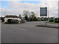
Manchester Arms, St Ives
Petrol prices have gone from 93p/litre to 138p/litre since Image
Image: © Hugh Venables
Taken: 16 May 2012
0.03 miles
3

Ditch alongside Somersham Road
Seen from Somersham Road on the edge of St Ives, this view looks along a ditch towards the roundabout which is a junction with the A1123.
Image: © Marathon
Taken: 3 May 2013
0.03 miles
4

The road to Ramsey and Pidley
The B1040 leads off from a roundabout at Stock's Bridge.
Image: © M J Richardson
Taken: 9 Feb 2018
0.03 miles
5
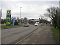
St Audrey Lane at Stock's Bridge
The A1123 heading east.
Image: © M J Richardson
Taken: 9 Feb 2018
0.04 miles
6

Old Guide Stone by the A1123, Needingworth Road, Saint Ives parish
Stone obelisk by the A1123, in parish of Saint Ives (Huntingdonshire District), Needingworth Road, St Ives Obelisk, junction with the B1086, opposite Manchester Arms, on grassed area.
Inscription reads:-
Miles to / SOMERSHAM / 5 / CHATTERIS / 11 {hand left} / MARCH / 19 / WISBECH / 30 :: To /LONDON / {hand left} / To / EARITH / To / ELY / 14 Miles / {hand right} :: To / ST IVES / and / LONDON / {hand right}
Grade II listed.
List Entry Number: 1128706 https://historicengland.org.uk/listing/the-list/list-entry/1128706
Surveyed
Milestone Society National ID: HU_XSIV
Image: © Mark Brotherton
Taken: 7 Nov 2023
0.05 miles
7

Old Guide Stone by the A1123, Needingworth Road, Saint Ives parish
Stone obelisk by the A1123, in parish of Saint Ives (Huntingdonshire District), Needingworth Road, St Ives Obelisk, junction with the B1086, opposite Manchester Arms, on grassed area.
Grade II listed.
List Entry Number: 1128706 https://historicengland.org.uk/listing/the-list/list-entry/1128706
Surveyed
Milestone Society National ID: HU_XSIV
Image: © Milestone Society
Taken: Unknown
0.05 miles
8
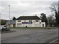
Tesco Express at Stock's Bridge
On the eastern outskirts of St Ives.
Image: © M J Richardson
Taken: 9 Feb 2018
0.05 miles
9

Roundabout, St Audrey Lane and Somersham road, St Ives
Roundabout at the end of St Audrey Road. Manchester Arms pub on the left, petrol station on the right, looking West along St Audrey Lane.
Image: © David Bartlett
Taken: 19 Jan 2007
0.06 miles
10

Roundabout at Somersham road junction in St Ives
This is the intersection of the B1040 and the A1123
Image: © David Bartlett
Taken: 6 Apr 2007
0.06 miles