
IMAGES TAKEN NEAR TO
Rookery Close, ST. IVES, PE27 5FX
Introduction
This page details the photographs taken nearby to Rookery Close, PE27 5FX by members of the Geograph project.
The Geograph project started in 2005 with the aim of publishing, organising and preserving representative images for every square kilometre of Great Britain, Ireland and the Isle of Man.

There are currently over 7.5m images from over14,400 individuals and you can help contribute to the project by visiting https://www.geograph.org.uk
Image Map
Images are licensed for reuse under creativecommons.org/licenses/by-sa/2.0
Notes
- Clicking on the map will re-center to the selected point.
- The higher the marker number, the further away the image location is from the centre of the postcode.
Image Listing (60 Images Found)
Images are licensed for reuse under creativecommons.org/licenses/by-sa/2.0
Image
Details
Distance
1

Parson's Drove public footpath
This is the start of the St Ives end of Parson's Drove near the Somersham road junction on the A1123.
Image: © David Bartlett
Taken: 6 Apr 2007
0.06 miles
2

Parson's Drove
A track along the eastern outskirts of St Ives.
Image: © M J Richardson
Taken: 9 Feb 2018
0.08 miles
3

McDonald's, St Ives
Recently built at Stock's Bridge, along with several other developments. Closed due to the coronavirus lockdown.
Image: © Hugh Venables
Taken: 17 May 2020
0.09 miles
4

Costa drive Thru
New service area at Stock's Bridge, on the edge of St Ives.
Image: © Hugh Venables
Taken: 17 May 2020
0.09 miles
5
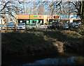
Subway and barbers
On a new development between the A1096 and Parson's Drove. The barber is shut for the coronavirus lockdown, the Subway on takeaway only.
Image: © Hugh Venables
Taken: 27 Feb 2021
0.09 miles
6

McDonald's drive through, St Ives
Very popular due to the coronavirus lockdown reducing other options.
Image: © Hugh Venables
Taken: 27 Feb 2021
0.10 miles
7

Roundabout, St Audrey Lane and Somersham road, St Ives
Roundabout at the end of St Audrey Road. Manchester Arms pub on the left, petrol station on the right, looking West along St Audrey Lane.
Image: © David Bartlett
Taken: 19 Jan 2007
0.10 miles
8

Roundabout at Somersham road junction in St Ives
This is the intersection of the B1040 and the A1123
Image: © David Bartlett
Taken: 6 Apr 2007
0.10 miles
9
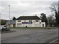
Tesco Express at Stock's Bridge
On the eastern outskirts of St Ives.
Image: © M J Richardson
Taken: 9 Feb 2018
0.11 miles
10

Parson's Drove public footpath
Heading away from St Ives this is just as the footpath is coming up to cross the A1096 (a dangerous pedestrian crossing point).
Image: © David Bartlett
Taken: 6 Apr 2007
0.11 miles