
IMAGES TAKEN NEAR TO
Great Whyte, HUNTINGDON, PE26 1HP
Introduction
This page details the photographs taken nearby to Great Whyte, PE26 1HP by members of the Geograph project.
The Geograph project started in 2005 with the aim of publishing, organising and preserving representative images for every square kilometre of Great Britain, Ireland and the Isle of Man.

There are currently over 7.5m images from over14,400 individuals and you can help contribute to the project by visiting https://www.geograph.org.uk
Image Map
Images are licensed for reuse under creativecommons.org/licenses/by-sa/2.0
Notes
- Clicking on the map will re-center to the selected point.
- The higher the marker number, the further away the image location is from the centre of the postcode.
Image Listing (51 Images Found)
Images are licensed for reuse under creativecommons.org/licenses/by-sa/2.0
Image
Details
Distance
1

Ramsey - Great Whyte
Wide Great Whyte can hold markets and parking. It is also a 13th century street name.
www.ramsey-town.co.uk
Image: © Colin Smith
Taken: 12 Jun 2021
0.05 miles
2
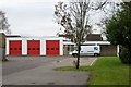
Ramsey fire station
Ramsey fire station, Great Whyte, Ramsey, Cambridgeshire
Image: © Kevin Hale
Taken: 4 Dec 2007
0.06 miles
3

Great Whyte, Ramsey
Taken from near the clock tower. Great Whyte iself is notable for being eighty feet wide. Its great width was the result of the culverting of the open waterway once navigable by small boats that used to run down the centre of this thoroughfare.
Image: © David Kemp
Taken: 2 Apr 2008
0.06 miles
4
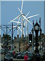
White sails in the sunshine
Turbines of Ramsey Wind Farm catch the sunlight over the shadowed roofs of Great Whyte.
Image: © Alan Murray-Rust
Taken: 14 Sep 2015
0.06 miles
5

Ramsey - Town Sign
Pictorial sign at the north end of Great Whyte.
www.ramsey-town.co.uk
Image: © Colin Smith
Taken: 12 Jun 2021
0.07 miles
6
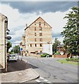
Flowers' Mill, Ramsey, Cambs.
This former flour mill was built for Thomas Flowers in 1882. It also saw service however, as a potato store and a grain drying establishment prior to its conversion into apartments in 1984. The complex, which includes a number of houses in the mill yard, is now known as "Rivermill Apartments". It was opened by the former local M.P. and former Prime Minister, Sir John Major. Bury Brook (a.k.a. High Lode), that once powered the mill, is situated at the other end of the mill.
Image: © David Hallam-Jones
Taken: 20 Aug 2019
0.07 miles
7
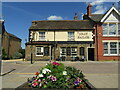
Ramsey - Jolly Sailor
Public house on Great Whyte, an extremely wide town centre street.
www.ramsey-town.co.uk
Image: © Colin Smith
Taken: 12 Jun 2021
0.07 miles
8
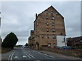
Rivermill Apartments, Ramsey
The date in the brickwork shows 1892, see http://ramsey-and-district.ccan.co.uk/content/catalogue_item/the-mill-great-whyte-ramsey-before-conversion-to-flats before conversion to Flats
Image: © Richard Humphrey
Taken: 2 Aug 2013
0.10 miles
9
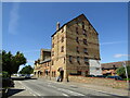
Ramsey - Mill
This former mill (1892) on Great Whyte is now Rivermill Apartments.
www.ramsey-town.co.uk
Image: © Colin Smith
Taken: 12 Jun 2021
0.10 miles
10

Flowers' Mill, Ramsey, Cambs.
This former flour mill was built for Thomas Flowers in 1882. However, it also saw service as a potato store and a grain drying establishment prior to its conversion into apartments in 1984. The complex, which includes a number of houses in the mill yard, is now known as "Rivermill Apartments". It was opened by the former local M.P. and Prime Minister, Sir John Major. Bury Brook (a.k.a. High Lode), that once powered the mill, is located to the photographer's right. The B1040 lies beyond the mill.
Image: © David Hallam-Jones
Taken: 20 Aug 2019
0.10 miles