
IMAGES TAKEN NEAR TO
Scarbrough Avenue, SKEGNESS, PE25 2TN
Introduction
This page details the photographs taken nearby to Scarbrough Avenue, PE25 2TN by members of the Geograph project.
The Geograph project started in 2005 with the aim of publishing, organising and preserving representative images for every square kilometre of Great Britain, Ireland and the Isle of Man.

There are currently over 7.5m images from over14,400 individuals and you can help contribute to the project by visiting https://www.geograph.org.uk
Image Map
Images are licensed for reuse under creativecommons.org/licenses/by-sa/2.0
Notes
- Clicking on the map will re-center to the selected point.
- The higher the marker number, the further away the image location is from the centre of the postcode.
Image Listing (235 Images Found)
Images are licensed for reuse under creativecommons.org/licenses/by-sa/2.0
Image
Details
Distance
1

Semi-detached hotels
Mayvene and Driftwood share a roof.
Image: © Bob Harvey
Taken: 6 Oct 2020
0.03 miles

3

Hotel in Scarborough Avenue
If I were them, I'd replace that missing letter, before the local roughnecks suggest a different one.
Image: © Bob Harvey
Taken: 6 Oct 2020
0.03 miles
4
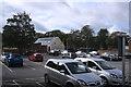
Car park in central Skegness
One of the spots popular with illegal parking by "travellers".
Image: © Bob Harvey
Taken: 6 Oct 2020
0.05 miles

6

Grosvenor House Hotel and Imperial Cafe
On the corner of Scarborough Avenue and Grand Parade. The cafe shows signs of being built as a rather grand ballroom in the days when the middle classes still holidayed in places like Skegness.
Image: © David Pickersgill
Taken: 4 Jul 2009
0.06 miles

8
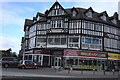
Four floors of mock tudor
An imposing building offering retail and holiday accommodation aplenty.
Image: © Bob Harvey
Taken: 6 Oct 2020
0.06 miles
9

Welcome to Skegness: hope you like the wind turbines! Aerial 2014
For aerial films of this area see: https://www.youtube.com/watch?v=wwhVamd4j6E and https://www.youtube.com/watch?v=zZjqzcMFXi8
These are LiDAR films of the Wolds and Marshes east of Louth. The films are narrated by Jim Broadbent. The land is colour-coded according to its elevation. The films show how the landscape was reclaimed for salt making and grazing. Footage includes ancient river systems, settlements, salterns and ridge and furrow. Produced for the Lincolnshire Coastal Grazing Marshes Project, which has now terminated.
Image: © Chris
Taken: 6 Dec 2014
0.06 miles
10

Mock Tudor buildings, Skegness
Corner of Scarborough Avenue and North Parade.
A plethora of businesses abound here.
Image: © Richard Hoare
Taken: 18 Jan 2015
0.07 miles