
IMAGES TAKEN NEAR TO
Skegness Road, SKEGNESS, PE24 5UB
Introduction
This page details the photographs taken nearby to Skegness Road, PE24 5UB by members of the Geograph project.
The Geograph project started in 2005 with the aim of publishing, organising and preserving representative images for every square kilometre of Great Britain, Ireland and the Isle of Man.

There are currently over 7.5m images from over14,400 individuals and you can help contribute to the project by visiting https://www.geograph.org.uk
Image Map
Images are licensed for reuse under creativecommons.org/licenses/by-sa/2.0
Notes
- Clicking on the map will re-center to the selected point.
- The higher the marker number, the further away the image location is from the centre of the postcode.
Image Listing (22 Images Found)
Images are licensed for reuse under creativecommons.org/licenses/by-sa/2.0
Image
Details
Distance
1

Garden Centre Car Park
A large gnome holds up nothing. Beyond the car park is the flat farmland of the Lincolnshire Marshes.
Image: © Tony Atkin
Taken: 17 Apr 2006
0.02 miles


5

Joining the A52
Leaving Chapel Garden Centre.
Image: © Alan Heardman
Taken: 17 Sep 2009
0.12 miles

7

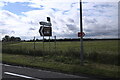
Village signboard
There is some doubt about whether Chapel St Leonards is a village, but the sign is in no doubt, talking about "village life by the seaside". This one is at the junction of Trunch Lane with the A52.
Behind is evidence of why this is known as "The Aluminium Coast"
Image: © Bob Harvey
Taken: 6 Oct 2020
0.14 miles
9
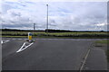
A road junction
we are standing in Trunch Lane - is there another of those anywhere? - looking at the mighty A52 road. There are no direction signs for merging traffic, but there is an ER evacuation route indicator. See Image
Image: © Bob Harvey
Taken: 6 Oct 2020
0.15 miles
10
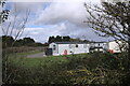
Eastview Static Park
Part of the Aluminium Coast
Image: © Bob Harvey
Taken: 6 Oct 2020
0.15 miles