
IMAGES TAKEN NEAR TO
Fairfield Avenue, SKEGNESS, PE24 5SB
Introduction
This page details the photographs taken nearby to Fairfield Avenue, PE24 5SB by members of the Geograph project.
The Geograph project started in 2005 with the aim of publishing, organising and preserving representative images for every square kilometre of Great Britain, Ireland and the Isle of Man.

There are currently over 7.5m images from over14,400 individuals and you can help contribute to the project by visiting https://www.geograph.org.uk
Image Map
Images are licensed for reuse under creativecommons.org/licenses/by-sa/2.0
Notes
- Clicking on the map will re-center to the selected point.
- The higher the marker number, the further away the image location is from the centre of the postcode.
Image Listing (13 Images Found)
Images are licensed for reuse under creativecommons.org/licenses/by-sa/2.0
Image
Details
Distance
1
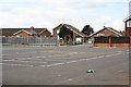
Modern Housing behind a Deserted Car Park
Image: © Tony Atkin
Taken: 17 Apr 2006
0.05 miles
2
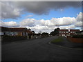
North end of Well Vale Drive, Chapel St Leonards
Looking towards Sea Road from the entrance to the main village car park.
Image: © Richard Vince
Taken: 26 Feb 2020
0.08 miles
3

Well Vale Close, Chapel St Leonards
Off Well Vale Drive.
Image: © Richard Vince
Taken: 26 Feb 2020
0.12 miles
4
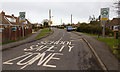
School Safety Zone
This 20 mph limit school safety zone is on Sea Road.
Image: © David P Howard
Taken: 1 Mar 2015
0.13 miles
5

Well Vale Court, Chapel St Leonards
An apparently unfinished cul de sac off Well Vale Drive.
Image: © Richard Vince
Taken: 26 Feb 2020
0.16 miles
6

New bungalows, Well Vale Court, Chapel St Leonards
At the end of the apparently unfinished road.
Image: © Richard Vince
Taken: 26 Feb 2020
0.17 miles
7

The Thatched Cottage
Picturesque though seemingly unoccupied cottage on Sea Road.
Image: © Richard Croft
Taken: 3 Sep 2010
0.20 miles
8
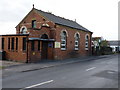
Methodist Chapel - Chapel St Leonards
The Methodist Chapel in the village. There was, until recently, a 'tin tabernacle' on the other side of the road, but it's been demolished and a new house built on the site before anyone managed to photograph it for this site. Shame.
Image: © Richard Law
Taken: 19 Mar 2011
0.21 miles
9
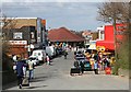
Chapel St Leonards
The village of Chapel St Leonards, known locally as just "Chapel", is a few miles north of Skegness on the Lincolnshire coast and is now part of the huge Skegness holiday area. This photograph was taken from the top of the pullover and looks down from the sea bank to the area of tourist shops, arcades and cafes.
The term 'pullover' stems from the days when it was commonplace to offload goods from ships beached on the shore onto horse-drawn carts. An extra horse was needed to pull the fully laden cart over the sea defence bank.
Image: © Tony Atkin
Taken: 17 Apr 2006
0.22 miles
10

The Methodist Church on St Leonards Drive
Image: © Mat Fascione
Taken: 24 Jul 2014
0.22 miles