
IMAGES TAKEN NEAR TO
Thames Crescent, SKEGNESS, PE24 5PS
Introduction
This page details the photographs taken nearby to Thames Crescent, PE24 5PS by members of the Geograph project.
The Geograph project started in 2005 with the aim of publishing, organising and preserving representative images for every square kilometre of Great Britain, Ireland and the Isle of Man.

There are currently over 7.5m images from over14,400 individuals and you can help contribute to the project by visiting https://www.geograph.org.uk
Image Map
Images are licensed for reuse under creativecommons.org/licenses/by-sa/2.0
Notes
- Clicking on the map will re-center to the selected point.
- The higher the marker number, the further away the image location is from the centre of the postcode.
Image Listing (33 Images Found)
Images are licensed for reuse under creativecommons.org/licenses/by-sa/2.0
Image
Details
Distance
1
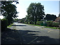
Thames Street, Hogsthorpe
Outside the school.
Image: © JThomas
Taken: 11 Sep 2015
0.06 miles
4
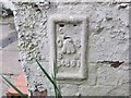
Ordnance Survey Flush Bracket G4681
This bracket can be found on the wall of a private dwelling in High Street, Hogsthorpe. The benchmark height is recorded as being 4.035 metres above sea level.
For more detail see : https://www.bench-marks.org.uk/bm13494
Image: © Peter Wood
Taken: 28 Feb 2019
0.11 miles
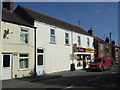
6
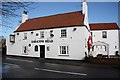
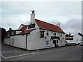
Saracen's Head
Historic hostelry in Hogsthorpe with early 18th century origins http://www.saracensheadhogsthorpe.co.uk/
Image: © Richard Croft
Taken: 13 Feb 2009
0.11 miles
7
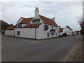
The closed version of The Saracen's Head Hogsthorpe
Definitely closed and boarded up now. See Image] May 2010.
However I noticed on Saturday, 22 February 2014, it has re-opened.
Image: © Richard Hoare
Taken: 22 Feb 2013
0.11 miles
8
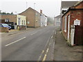
High Street (A52) in Hogsthorpe approaching its junction with South End and Mill Lane
Looking south-eastward.
Image: © Peter Wood
Taken: 28 Feb 2019
0.12 miles
9
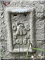
Flush Bracket OSBM G4681: Hogsthorpe
Flush bracket bench mark on a former post office, now a private house. See https://www.geograph.org.uk/photo/6911609 for a wider view and https://www.bench-marks.org.uk/bm13494 for details of the mark.
Image: © Brian Westlake
Taken: 23 Jul 2021
0.12 miles
10
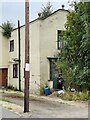
House with a Benchmark
There is a flush bracket bench mark on this house, a former post office. It is located behind the gas cylinder. See https://www.geograph.org.uk/photo/6911604 for a closer view and https://www.bench-marks.org.uk/bm13494 for details of the mark.
Image: © Brian Westlake
Taken: 23 Jul 2021
0.12 miles