IMAGES TAKEN NEAR TO
Church Lane, SKEGNESS, PE24 4HP
Introduction
This page details the photographs taken nearby to Church Lane, PE24 4HP by members of the Geograph project.
The Geograph project started in 2005 with the aim of publishing, organising and preserving representative images for every square kilometre of Great Britain, Ireland and the Isle of Man.

There are currently over 7.5m images from over14,400 individuals and you can help contribute to the project by visiting https://www.geograph.org.uk
Image Map
Images are licensed for reuse under creativecommons.org/licenses/by-sa/2.0
Notes
- Clicking on the map will re-center to the selected point.
- The higher the marker number, the further away the image location is from the centre of the postcode.
Image Listing (5 Images Found)
Images are licensed for reuse under creativecommons.org/licenses/by-sa/2.0
Image
Details
Distance
2
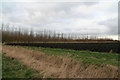
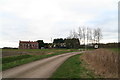
Black kale and a new plantation on Church Lane, around the site of the Medieval Town of Wainfleet
Image: © Chris
Taken: 28 Feb 2017
0.08 miles
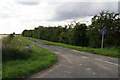
3
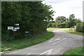
The junction of Washdike Lane
Staggered 4-way junction.
Image: © Chris
Taken: 11 Aug 2013
0.14 miles
4
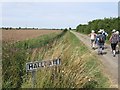
Hallgate
Cul-de-sac which turns into footpath leading to and through Low Grounds.
Image: © Chris
Taken: 11 Aug 2013
0.16 miles